Introduction to Tagofy - Geotag Map Camera
Are you passionate about capturing your travel experiences or exploring new places? Tagofy - Geotag Map Camera is a robust mobile application designed to help you document your journeys with precise geographical data embedded directly into your photos. Available for both Android and iOS devices, this app allows users to add detailed information such as •"geotag", •"date-time", •"latitude", •"longitude", •"altitude", weather conditions, magnetic field data, timestamp, and compass details effortlessly. This comprehensive feature set ensures that every snapshot you take isn't just a picture but a story with geographical context, making your travel memories more vivid and organized.
Key Features of Tagofy - Geotag Map Camera
Seamless Geotagging and Photo Capture
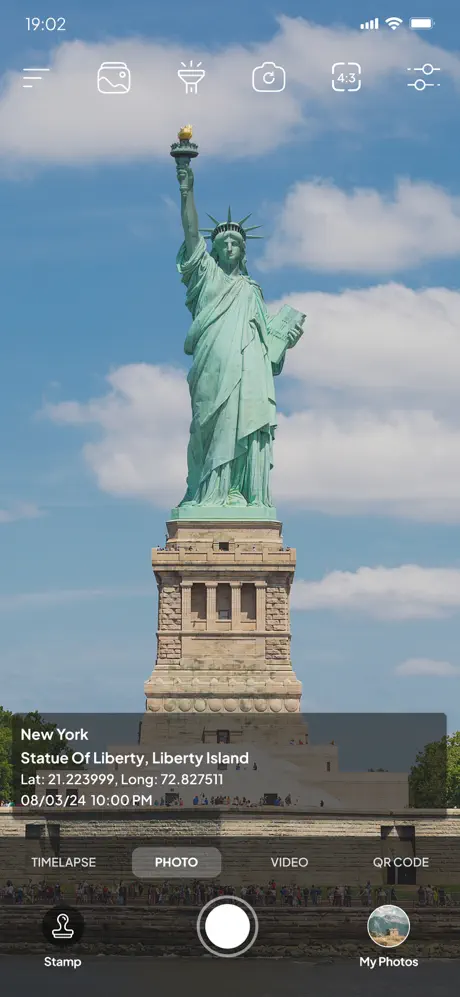
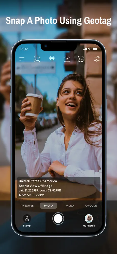
The app enables you to capture high-quality photos with embedded GPS location data without additional hassle. Imagine standing at a breathtaking viewpoint like the Grand Canyon—every photo taken with Tagofy will automatically include the precise •"geotag" and other relevant metadata, creating a detailed record of your visits. The intuitive interface ensures that whether you're a tech-savvy user or a beginner, you can effortlessly point, shoot, and have your photos automatically tagged with the location details.
Customizable Timestamps and Watermarks
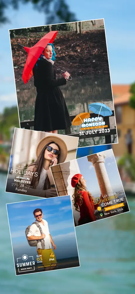
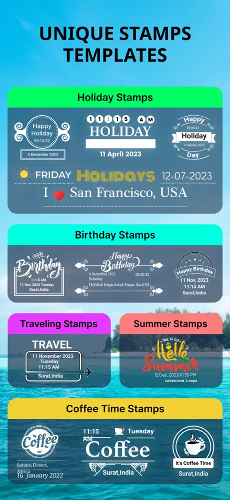
One of the standout features is the ability to add customizable timestamp watermarks. You can choose different formats and positions for date and time stamps, allowing your photos to serve as both visual memories and documented records. This makes the app an invaluable tool for travelers, adventurers, and storytellers who want to preserve the exact moment and location of their adventures.
Advanced Geotagging Options
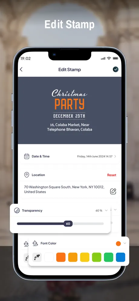
Tagofy offers an extensive set of tools for location customization. In the Advance Template section, users can add:
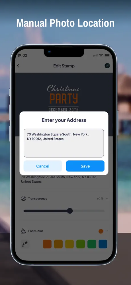
- •"Address": automatically fetch or manually input location info
- •"Date & Time": include timestamps in various formats
- •"Logo": upload personal or brand logos for customized branding
- •"Note": annotate photos with relevant remarks
- •"Hashtags": organize and enhance discoverability in social sharing
Additional Functionalities for Creative Control
The app's versatility is further demonstrated by features like:
- Custom GPS camera setups with options for grid, ratio, front & selfie camera, flash, focus, mirror, timer, and capture sounds
- Automatic location data setting for quick tagging
- High-quality video recording in MOV or MP4 formats with adjustable quality and bitrate
- Time-lapse video recording with stabilization
- Built-in QR scanner for quick access to links or codes
- Customizable user interface with shortcuts such as text, tags, and lock screen options
- Configurable email sharing settings for swift distribution of geotagged photos and videos
Using Tagofy - Geotag Map Camera Effectively
Simple Steps to Add GPS Location to Photos
- Install the Tagofy - Geotag Map Camera app from your device's app store.
- Open the app and tap the stamp icon displayed on the screen; customize the stamp layout according to your preference.
- Adjust the format and placement of location and timestamp data to suit your needs.
- Capture photos within the app, which will automatically add geolocation and other details onto your images.
This streamlined process ensures that each photo carries rich geotag data, helping you organize and recall your travels with ease.
Enhance Your Travel Memories
Whether you're exploring new cities, hiking remote trails, or capturing family moments, Tagofy allows you to keep a detailed record of your adventures. Share your geotagged photos with family and friends directly from the app or through social media platforms. Your loved ones can see the exact locations of your visits, making them feel like they're right there with you.
Offline Mode and Resource Efficiency
One of the app's notable advantages is its ability to work offline. Even in locations with no internet connectivity, Tagofy logs your actual location data and uploads when you're back online. Its lightweight design ensures minimal battery drain and optimal performance across a broad range of devices.
Target Audience and Benefits
This powerful geotagging camera app is perfect for explorers, travel bloggers, event organizers, and anyone eager to preserve detailed memories of their journeys. By adding location stamps, date, time, and personalized notes, users enhance the storytelling aspect of their photos. Tagofy transforms basic images into comprehensive visual diaries, making your travel stories more engaging and discoverable.
With features like customizable templates, branding options, and advanced metadata controls, Tagofy - Geotag Map Camera is not just a photo app—it's your digital travel companion. Capture your adventures with precise location data, share moments effortlessly, and keep your memories alive with enriched geotagged photos and videos.
Conclusion
If you’re a traveler, explorer, or photographer looking to add depth and context to your images, Tagofy - Geotag Map Camera is an indispensable tool. Its easy-to-use interface, comprehensive features, and reliable performance make it ideal for documenting every journey with accuracy. Embrace the power of geotags, and make your memories truly unforgettable with Tagofy—your perfect partner for stunning, location-aware photography.
Pros
- Easy geotagging for photos
- User-friendly interface
- Supports multiple languages
- Customizable watermark options
- Works offline effectively
Cons
- Limited editing features
- Requires large storage space
- Occasional GPS inaccuracies
- Ads in free version
- Limited cloud integration