Introduction to Solocator - GPS Field Camera
Solocator is a versatile GPS camera designed specifically for fieldwork and photographic proof. Whether you're an outdoor enthusiast, surveyor, or professional documenting site conditions, Solocator offers a powerful set of features to overlay and stamp photos with critical location and environmental data. This innovative mobile app seamlessly combines functionality and ease of use, making it an essential tool for capturing precise photographic documentation in various industries worldwide.
Key Features and Functionalities
Select and Customize Overlay Information
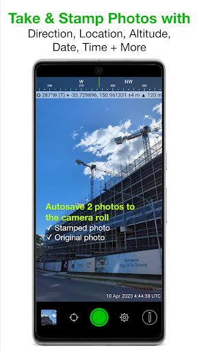
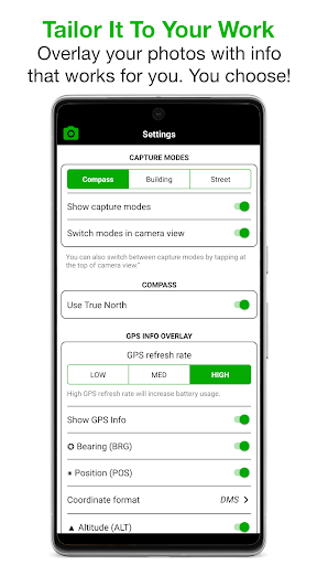
With Solocator, you can tailor the information you want to overlay on your photos. Choose to include GPS position (Latitude & Longitude) in multiple formats, UTM/MGRS coordinates via the Industry Pack, compass direction (bearing), altitude in metric or imperial units, and even tilt & roll angles. The app also offers the ability to show your local date & time based on GPS location, UTC time, and a street address (additional features available through the Industry Pack). For enhanced clarity, users can opt for abbreviations or Unicode characters to represent directions and positions, ensuring the overlays meet specific project requirements.
Camera and Image Capture
Designed for both back and front selfie cameras, Solocator supports pinch zoom, self-timer, flash, and exposure controls. The app allows for autosaving photos to your camera roll, capturing both the overlayed image and the original, unaltered photo simultaneously. This dual capture capability ensures you retain the raw image for reference or backup while having a stamped version for documentation.
Organization and Sharing
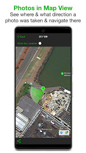
Photos are systematically sorted by time, location, distance, and project name when using the Industry Pack. Users can view photo locations and directions in map view, enabling easy navigation. Photos can be shared individually or as ZIP files via the share sheet, and e-mailed with comprehensive metadata, including Exif data, GPS coordinates, altitude, tilt & roll, date & time, and street address. The app even provides links to maps for easy navigation from shared images.
Industry Pack and Advanced Features
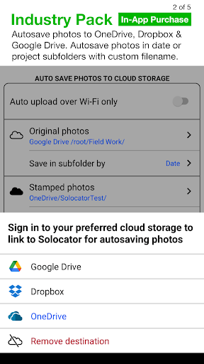
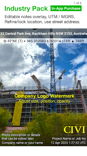
The optional Industry Pack (In-App Purchase) unlocks advanced functionalities like editing notes, stamping project names, descriptions, and watermarks, as well as defining custom export filenames. You can add street addresses and UTM/MGRS coordinates to your overlays and manage multiple photos' notes simultaneously with batch editing tools. The pack also enables automatic cloud storage integration with Google Drive, Dropbox, OneDrive, SharePoint, and Teams, allowing automatic saving in project- or date-specific folders.
Photo Data Export and Map Visualization
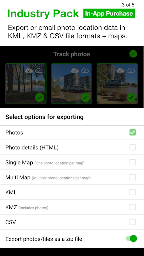
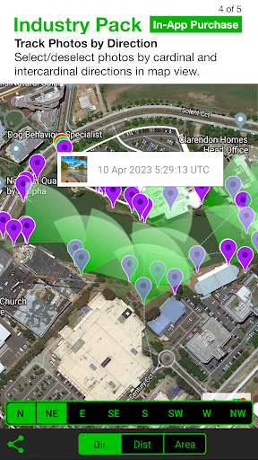
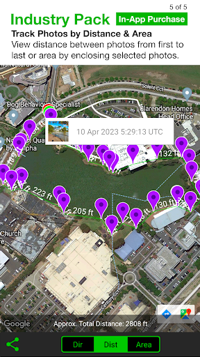
Beyond basic sharing, Solocator allows exporting comprehensive photo data in formats such as KML, KMZ, and CSV. These exports include location details, notes, and other metadata, perfect for geospatial analysis or record-keeping. The map view feature enables users to visualize photos by direction, distance, and area, aiding in precise fieldwork and site assessments.
Refining and Locking GPS Locations
For enhanced accuracy, especially in challenging environments, users can refine and lock GPS locations. This function is particularly useful for architectural or construction projects where precise positioning is critical. Additionally, a compact view mode offers a simplified interface by hiding modes like Compass and Building details for streamlined photo capture.
Device Compatibility and Additional Notes
Starting from version 2.18, Solocator has been optimized for devices without a magnetometer (compass sensor). While some directional features might be limited on such devices, upgrading to a device with a compass will enable full functionality. This adaptability ensures broad compatibility across different smartphones and tablets.
User Experience and Practical Applications
Many users find Solocator an invaluable companion for outdoor adventures, construction sites, survey missions, or even urban explorations. Its ability to automatically record precise GPS data, overlay critical location information, and export detailed reports makes it more than just a camera app — it becomes a portable field journal. Whether you're documenting wildlife, mapping utility infrastructure, or capturing construction progress, Solocator combines practicality with technical precision.
Final Thoughts
In summary, Solocator - GPS Field Camera is a comprehensive tool that elevates standard photography by adding detailed geospatial data overlays. Its user-friendly interface, customizable features, and cloud integration make it ideal for professionals and hobbyists alike. While there might be a slight learning curve initially, mastering its features unlocks a new level of accuracy and documentation power. Whether you're exploring nature, conducting surveys, or simply want to enhance your travel photos with location context, Solocator offers an all-in-one solution to capture, organize, and share your photographic evidence with confidence.
Pros
- Accurate GPS tagging for photos.
- User-friendly interface for quick captures.
- Provides multiple overlays for contextual information.
- High-resolution image capturing capability.
- Smooth integration with cloud services.
Cons
- Limited free features are available.
- App occasionally crashes.
- Battery consumption is high during use.
- Map loading times can be slow.
- Lacks night mode for low-light photography.