

Overview of Tactical NAV
If you have ever found yourself in the wilderness or navigating challenging environments, you know how critical it is to have a reliable and precise navigation tool at your fingertips. Tactical NAV is a powerful mobile application designed to meet the needs of military personnel, outdoor enthusiasts, and first responders alike. Built with military-grade accuracy and user-friendly features, this app elevates navigation to a new level of reliability and efficiency. Whether you're in the field or exploring remote areas, Tactical NAV provides the confidence and precision you need for successful operations and adventures.
Background and Development of Tactical NAV
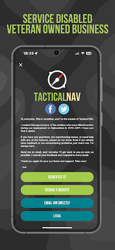
Created during a combat deployment to Afghanistan, Tactical NAV was born out of a necessity to enhance soldier safety and mission success. It was developed in the rugged mountains of eastern Afghanistan by U.S. Army Capt. Jonathan J. Springer, a Field Artillery officer dedicated to honoring fallen comrades and supporting fellow service members. The app was conceived in the Kunar Province’s Pech River Valley, inspired by the memory of soldiers like Spc. Blair D. Thompson and Spc. Jared C. Plunk. Despite initial rejection from the Department of Defense, Captain Springer persisted, funding its development with his own savings. His unwavering commitment aimed to create a low-cost, highly accurate navigation solution that could aid soldiers in the field and save lives. Tactical NAV officially launched on February 14, 2011, on both the App Store and Google Play, marking a significant advancement in military navigation technology.
Core Features and Technical Excellence
Built for Accuracy and Reliability
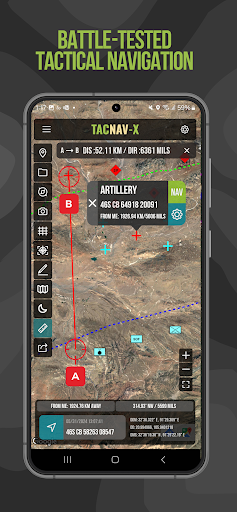
Tactical NAV’s performance is comparable to the renowned AN/PSN-13 Defense Advanced GPS Receiver (DAGR). It provides within 1mm of accuracy, verified against other approved systems such as Nett Warrior, ATAK, and BFT. This level of precision is essential for tactical operations where every meter matters. The app leverages MGRS (Military Grid Reference System), UTM (Universal Transverse Mercator), BNG (British National Grid), and USNG (United States National Grid) coordinate standards, ensuring precise positioning in diverse environments.
Key Functionalities
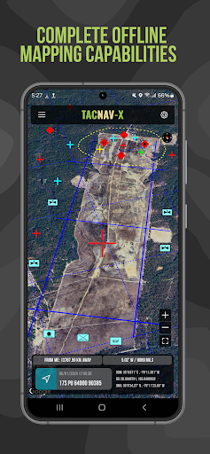
- Offline mapping capabilities allow users to operate the app without cellular signals—a vital feature in remote or contested locations.
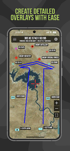
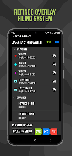
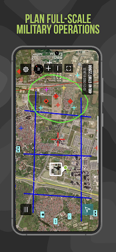
- Tactical drawing mode supports mission planning, overlay creation, and target building.
- Waypoint plotting with military graphics helps in navigation and coordination (per FM 1-02.2).
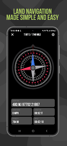
- The FastLock compass feature captures quick azimuths for rapid orientation.
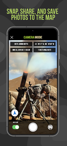
- Users can capture and save photographs directly onto the map to enhance situational awareness.
- Map data, waypoints, and photos can be shared via email or text, enabling seamless communication.
- The Go to Grid feature allows for precise planning, overlay drawing, and waypoint dropping.
- Built with Android native code, making it suitable for austere and contested environments.
- Tactical drawing mode supports mission planning, overlay creation, and target building.
- Waypoint plotting with military graphics helps in navigation and coordination (per FM 1-02.2).
- The FastLock compass feature captures quick azimuths for rapid orientation.
- Users can capture and save photographs directly onto the map to enhance situational awareness.
- Map data, waypoints, and photos can be shared via email or text, enabling seamless communication.
- The Go to Grid feature allows for precise planning, overlay drawing, and waypoint dropping.
- Built with Android native code, making it suitable for austere and contested environments.
Subscription and Development Support
Tactical NAV offers in-app purchases and subscriptions—such as the tactical drawing mode and offline mapping. Revenue from these helps fund ongoing updates and improvements, with a portion donated to charities supporting disabled veterans. This commitment reflects the app’s core mission of aiding and honoring service members.
Why Tactical NAV Stands Out
If you’re a military professional, outdoor enthusiast, or first responder, Tactical NAV is an essential addition to your toolkit. Its military-quality accuracy and intuitive interface make it accessible to users of varying tech skills, while advanced features like tactical drawing and offline mode provide the reliability needed in critical situations. Its robust performance, seamless sharing capabilities, and precise navigation functionalities ensure that users can plan and execute operations with confidence.
Designed specifically for individual soldiers and tactical teams, this app combines precision, usability, and customizability, making it a versatile solution for a variety of mission types or outdoor adventures.
Designed specifically for individual soldiers and tactical teams, this app combines precision, usability, and customizability, making it a versatile solution for a variety of mission types or outdoor adventures.
Conclusion
In summary, Tactical NAV is a comprehensive, reliable, and expertly crafted navigation app tailored for demanding environments. Whether used in combat situations, training exercises, or outdoor exploration, it provides the tools needed to navigate accurately and efficiently. Its dedication to quality, accuracy, and supporting military and veteran communities makes it a trusted choice for anyone seeking a top-tier navigation application. If you're serious about your navigational needs, Tactical NAV is a tool that truly delivers—and can make the difference between success and failure in critical moments.
Pros
- Comprehensive GPS navigation tailored for military applications.
- Supports real-time location sharing with team members.
- Allows customizable map overlays for mission planning.
- Provides offline maps suitable for remote regions.
- Features an intuitive interface for quick navigation.
Cons
- Limited functionality available in the free version.
- Requires frequent updates to ensure map accuracy.
- Consumes a significant amount of battery during use.
- May be complicated for users outside the military context.
- Potential concerns regarding data security.











