
Discover the Ultimate Offline Topographic Navigation with NZ Topo50 Offline - North
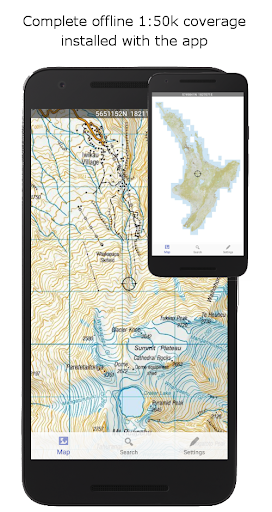
For outdoor enthusiasts exploring New Zealand's North Island, having a reliable navigation tool is essential. The NZ Topo50 Offline - North app offers complete 1:50,000 offline topographic map coverage using the prestigious LINZ NZTopo50 series. This means you can enjoy detailed maps fully integrated within the app—no additional downloads, no account signups, and no hidden fees. Whether you're venturing into remote backcountry areas or just exploring popular trails, this app provides seamless pan and zoom capabilities across the entire North Island, making it an invaluable companion for trampers, walkers, bikers, runners, hunters, search and rescue teams, and Te Araroa trekkers.
Comprehensive Features Designed for Adventure
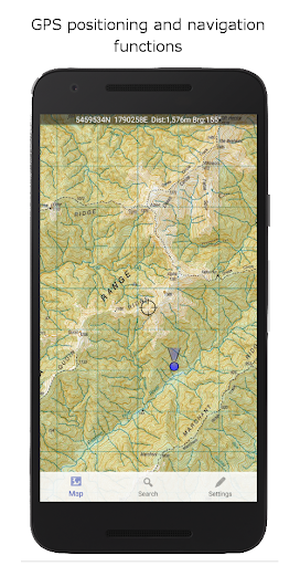
The app boasts powerful navigation functionalities that cater to both casual explorers and seasoned adventurers. Built to use the NZ national map grid instead of the common global WGS84 datum, it ensures accurate alignment with LINZ maps—resulting in >perfectly parallel gridlines when projected. This feature enhances navigation precision, making it easier to plan routes and identify your position accurately. The core features include GPS positioning for real-time location updates, track logging to record your journeys, and user waypoints for marking important spots.
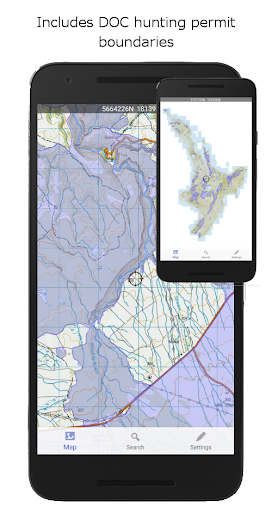
Additional tools include route creation and route following, the ability to search for and zoom to named places and features, and altitude and speed display for better awareness. For added convenience, you can import, export, and share tracks and waypoints via kml or gpx formats. Overlays such as DOC hunting boundaries, Te Araroa tracks, and other data layers are included to improve your planning and awareness during outdoor activities.
Seamless Offline Experience in the Great Outdoors
This app is designed explicitly for offline use, meaning you can navigate without internet or cellular service—an essential feature in remote New Zealand terrains. The maps are embedded fully into the app, ensuring no missing tiles or delays. Whether you're on a mountain trail, in dense forest, or leading a search operation, you can pan and zoom freely across detailed topographic maps that display contour lines, river paths, and elevation details. The app's use of the NZ-specific map grid makes navigation even more reliable, providing a trustworthy experience for hunter or search and rescue team members.
Keep in mind, the maps require significant storage space—so ensure your device has enough capacity to support this extensive and detailed mapping coverage.
User-Friendly Design for Every Explorer
The interface of NZ Topo50 Offline - North is sleek, intuitive, and straightforward. It’s crafted for users of all skill levels, allowing quick setup—often in less than ten minutes after installation. The clear, high-resolution maps remain easily readable even under bright sunlight, enhancing usability during daytime outdoor activities.
Dropping pins, planning routes, or marking points of interest is straightforward, making route planning a breeze. The app is resource-efficient, employing minimal battery power while delivering powerful navigation tools. Whether you’re a avid hiker, biker, or hunter, the seamless experience encourages exploration with confidence.
Empower Your Adventure with NZ Topo50 Offline - North
If you're heading into the North Island's rugged landscapes or exploring its scenic trails, NZ Topo50 Offline - North is your perfect navigation partner. Its detailed maps, offline capabilities, and user-friendly features make every outdoor journey safer and more enjoyable. No internet fuss, just reliable, accurate navigation right at your fingertips. Prepare your gear, download this comprehensive app, and get ready to explore New Zealand’s wilderness with confidence. Happy exploring!
Pros
- Access to detailed topographic maps offline.
- User-friendly interface for easy navigation.
- Regular updates with new map data.
- Extensive coverage of North New Zealand.
- Functionality without an internet connection.
Cons
- Limited to the North New Zealand region.
- May require storage space for offline maps.
- Lacks real-time GPS tracking.
- Paid application with no free version available.
- Interface might be overwhelming for beginners.











