
Discover the Power of Navionics® Boating
If you love sailing, cruising, fishing, diving, or any activity on the water, Navionics® Boating is the indispensable app designed to elevate your marine experience. With up-to-date detailed charts accessible offline and a suite of advanced features, this app ensures you're always well-prepared, no matter where your adventures take you. Its user-friendly interface caters to both beginners and seasoned sailors, offering seamless navigation, planning tools, and community-driven insights that make every trip safer and more enjoyable. Whether you're planning a weekend getaway or an extended voyage, Navionics has got you covered.
Extensive Marine Charts and Customization Options
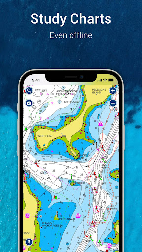
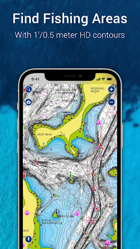
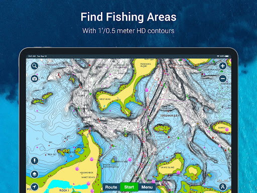
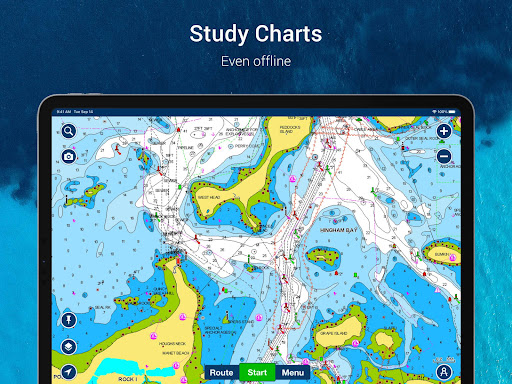
At the core of the Navionics® Boating app is its comprehensive collection of charts, including Nautical Charts for port plans, anchorages, and safety contours, and Sonarchart™ HD Bathymetry Maps offering incredible 0.5-meter resolution to locate prime fishing spots or explore underwater terrain. The app also integrates U.S. Government NOAA charts covering the U.S., Canada, Mexico, Caribbean, and beyond, providing reliable and authoritative navigation data.
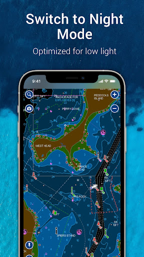
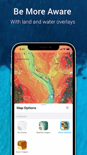
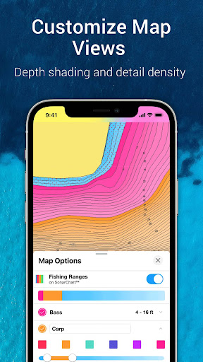
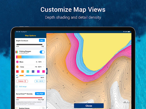
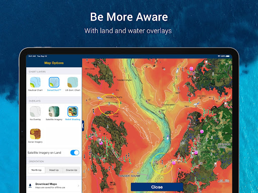
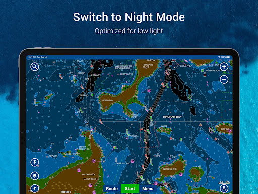
Customization is key; you can change chart overlay combinations, activate night mode for low-light conditions, and highlight shallow or fishing zones. For added clarity, overlay relief shading to better visualize bottom topography and utilize sonar imagery for detailed lakebed views. Plus, satellite imagery overlay helps you identify land features, docks, and marinas. Daily updates—up to 5,000 worldwide—ensure your charts remain current and accurate, essential for safe navigation and optimal fishing.
Customization is key; you can change chart overlay combinations, activate night mode for low-light conditions, and highlight shallow or fishing zones. For added clarity, overlay relief shading to better visualize bottom topography and utilize sonar imagery for detailed lakebed views. Plus, satellite imagery overlay helps you identify land features, docks, and marinas. Daily updates—up to 5,000 worldwide—ensure your charts remain current and accurate, essential for safe navigation and optimal fishing.
Tools to Enhance Your Waterway Experience
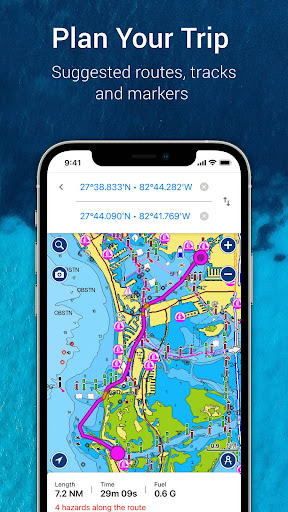
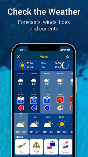
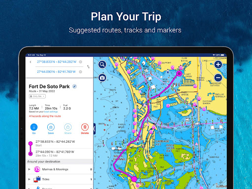
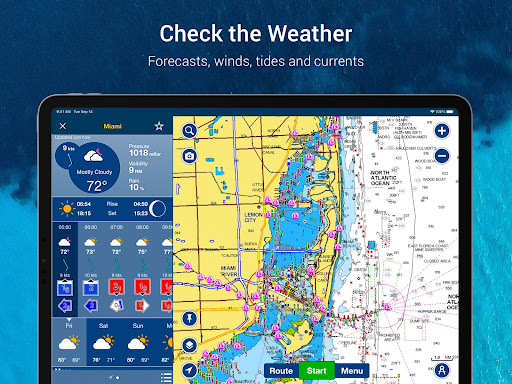
Planning your trip is simplified with Auto Guidance+™ Technology, which suggests dock-to-dock routes based on chart data and navigation aids, providing estimated time of arrival, distance, heading, and fuel consumption. The app gives you real-time weather and tide information, empowering you to make informed decisions before heading out. Access hourly forecasts, wind data, buoy reports, tides, and currents—all vital for safe and enjoyable outings.
Keep track of your day with features like markers, tracks, and distance measurements. Drop pins at key locations, record your routes, capture photos and videos, and easily check distances between points. These tools are perfect for marking good anchorage spots or tracking your fishing catches, making each trip memorable and well-documented.
Keep track of your day with features like markers, tracks, and distance measurements. Drop pins at key locations, record your routes, capture photos and videos, and easily check distances between points. These tools are perfect for marking good anchorage spots or tracking your fishing catches, making each trip memorable and well-documented.
Community Engagement and Sharing Capabilities
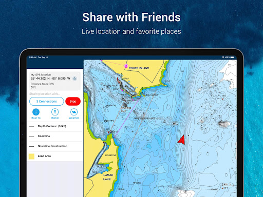
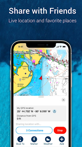
One of the standout qualities of Navionics is its vibrant community. Users can contribute community edits and share local knowledge, points of interest, and valuable tips through the ActiveCaptain® Community. This collective insight enhances your navigation experience, especially in unfamiliar waters. You can share your live location, routes, markers, and tracks with friends or fellow boaters, making social coordination on the water straightforward.
The app supports GPX import/export for sharing your saved data outside the platform or transferring it to compatible chartplotters. Additionally, you can share specific locations like marinas or repair shops beyond the app’s ecosystem, facilitating seamless communication and planning.
The app supports GPX import/export for sharing your saved data outside the platform or transferring it to compatible chartplotters. Additionally, you can share specific locations like marinas or repair shops beyond the app’s ecosystem, facilitating seamless communication and planning.
Seamless Integration with External Devices and Advanced Features
For those with compatible hardware, Navionics extends its functionality through Plotter Sync, enabling route and marker transfer, subscription updates, and chart management directly with your chartplotter. The Sonarchart Live Mapping feature allows real-time map creation using connected sonar/plotter devices, giving you personalized underwater maps while on the move.
Safety is enhanced with AIS connectivity, providing real-time marine traffic info, visual and audible collision alerts, and a safe range setup. This integration ensures you’re aware of nearby vessels, reducing risks during busy waterways.
Safety is enhanced with AIS connectivity, providing real-time marine traffic info, visual and audible collision alerts, and a safe range setup. This integration ensures you’re aware of nearby vessels, reducing risks during busy waterways.
Why Navionics® Boating Is the Top Choice for Water Enthusiasts
Whether you're a casual angler or a seasoned mariner, Navionics® Boating is built to support your adventures with an intuitive interface and powerful features. Its offline maps, comprehensive chart library, and dynamic planning tools make navigation safer and more efficient. The community features keep you connected, sharing local insights and travel experiences. Plus, its compatibility with external devices enhances functionality, offering a versatile and robust marine navigation solution.
Try it free during the trial period, and explore features like Auto Guidance+™, detailed bathymetry, real-time weather updates, and user-generated content. With Navionics, you're equipped with a reliable digital first mate, helping you enjoy your time on the water to the fullest. From fishing trips to sailing adventures, this app is your ultimate companion for navigating the open waters confidently.
Try it free during the trial period, and explore features like Auto Guidance+™, detailed bathymetry, real-time weather updates, and user-generated content. With Navionics, you're equipped with a reliable digital first mate, helping you enjoy your time on the water to the fullest. From fishing trips to sailing adventures, this app is your ultimate companion for navigating the open waters confidently.
Pros
- Comprehensive nautical charts.
- Real-time weather updates.
- User-friendly interface.
- Offline map access.
- Community edits for accuracy.
Cons
- High subscription cost.
- Limited free features.
- Battery drains quickly.
- Occasional app crashes.
- Requires internet for updates.











