
Discover the Best Stargazing Spots with the Light Pollution Map App
Are you passionate about astronomy or simply love gazing at the night sky, but often find yourself disappointed by the overwhelming glow of light pollution? In today’s urbanized world, **light pollution** has become a major obstacle for stargazers, sky enthusiasts, and those seeking serene, dark skies. The Light Pollution Map app is here to change that, serving as an essential tool for finding optimal locations for observing stars, planning nighttime adventures, or even purchasing that perfect piece of land for future stargazing.
What Is the Light Pollution Map App?
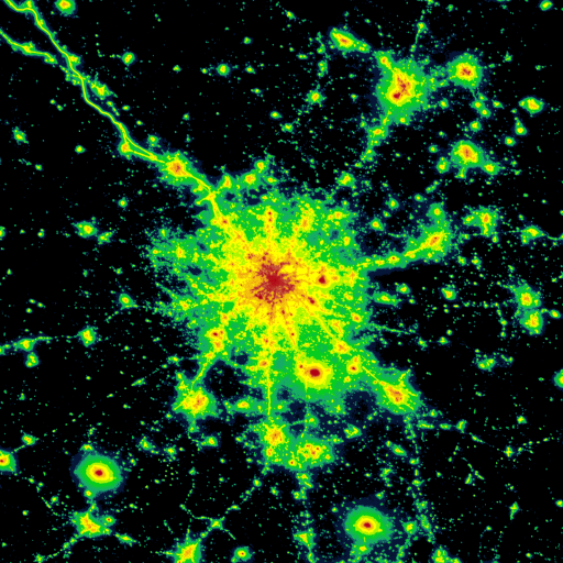
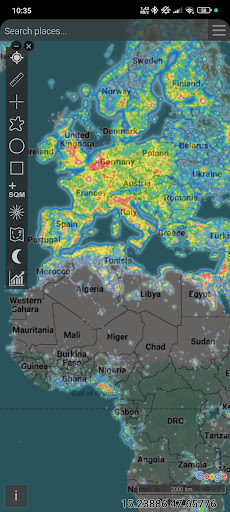
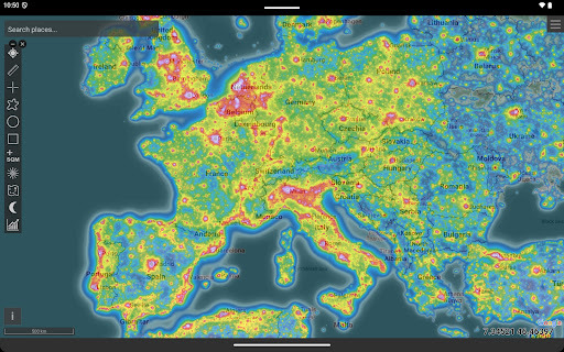
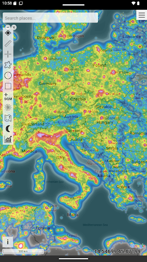
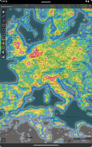
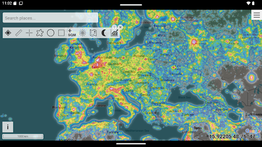
This innovative application functions as a detailed light pollution map, providing users with a visual representation of light pollution levels across various regions. Originally launched as a web-based platform at www.lightpollutionmap.info, it has now expanded into a versatile mobile app compatible with both Android and iOS devices. Whether you're a professional astronomer or a casual sky watcher, this app serves as your personal guide to uncovering dark skies.
Key Features and Overlays
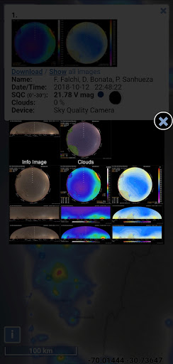
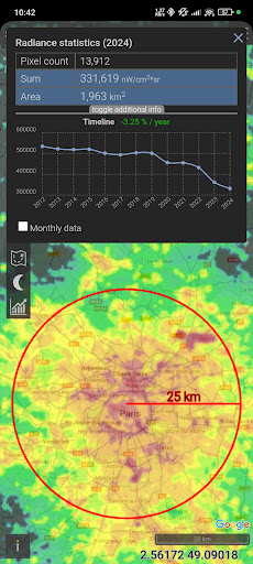
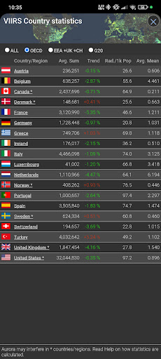
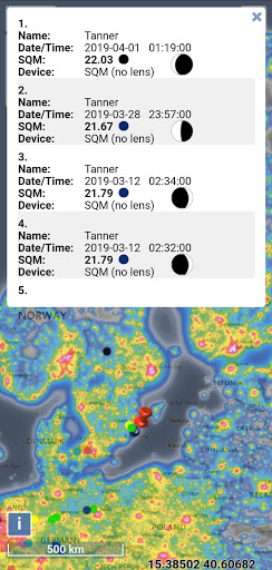
The Light Pollution Map app boasts an array of robust features that make locating ideal stargazing spots more accessible than ever. Supported overlays include VIIRS, DMSP, World Atlas, and Aurora visuals, all rendered over familiar Microsoft Bing maps—complete with road and hybrid views—helping users navigate comfortably. The app also displays the positions of IAU observatories, enabling users to find renowned astronomical facilities nearby. Its user measurements feature allows enthusiasts to contribute real-time SQM (Sky Quality Meter) readings, fostering a community-driven approach to data accuracy.
Additional Useful Overlays
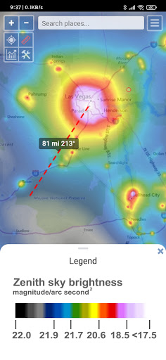
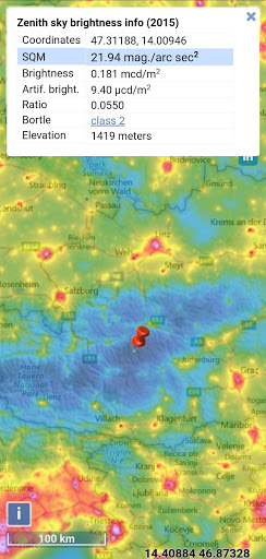
Beyond basic light pollution data, the app features overlays such as cloud coverage, aurora forecasts, and zenith brightness based on the World Atlas 2015. For users with SQM detectors, the app supports adding permanent meters—simply by contacting the developers—making ongoing measurements easier and more consistent. A special offline mode ensures you can access maps even without an internet connection, downloading necessary data in advance for on-the-go planning.
Functionalities That Stand Out
The Light Pollution Map app includes formidable functionalities designed for the discerning astronomer and the casual stargazer alike. These include:
- VIIRS, Sky Brightness, Cloud Coverage, and Aurora Forecast Layers
- Color-blind friendly display options for easier interpretation
- Real-time detailed radiance and SQM measurements at your fingertips
- Estimations of Bortle class to evaluate sky darkness
- Save your favorite viewing spots and measure distances with azimuth angle reports
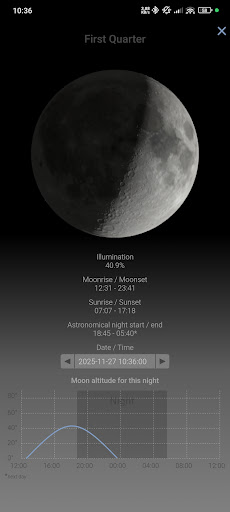
- Weather-related layers and astronomical event filters for comprehensive planning
- Community contributions—submit your own SQM readings to enhance the shared database
Easy to Use and Practical
Getting started is straightforward: download the app, enable location permissions, and it will automatically identify your current position, showing light pollution levels nearby. You can explore different regions by simply dragging and zooming the map, which makes planning trips to darker, more suitable skies effortless. Additionally, the app offers a customizable interface where you can toggle various data layers—factoring in weather, cloud cover, and upcoming astronomical events—helping you optimize your stargazing sessions. The technology also utilizes permissions such as location access and storage to enhance offline usability and map saving capabilities.
Final Thoughts: Your Gateway to Clear Skies
In an era where urban light pollution dims the stars, the Light Pollution Map app emerges as a vital resource for anyone eager to reconnect with the night sky. Whether you’re seeking remote dark-sky areas, monitoring light pollution trends over time, or simply planning your next stargazing adventure, this app provides comprehensive tools and data to guide your way. Embrace the opportunity to witness the universe’s wonders—download the app today, find your ideal dark sky location, and experience the cosmos like never before.
Pros
- Provides real-time data on light pollution levels.
- Offers highly accurate and dependable measurements.
- Features an intuitive interface for straightforward navigation.
- Allows customization of map views to suit specific requirements.
- Supports offline access to previously saved maps.
Cons
- Dependent on internet connection for live data updates.
- Can deplete mobile device battery quickly.
- Limited functionality available in the free version.
- May be overwhelming for first-time users.
- Sometimes experiences glitches when loading maps.











