


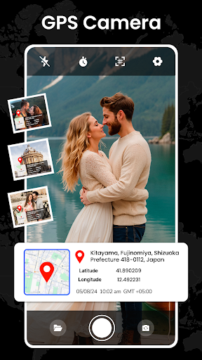
Introduction to GPS Earth Maps Live Navigation
Are you tired of getting lost in unfamiliar cities or navigating complex street layouts? GPS Earth Maps Live Navigation is the ultimate travel companion designed to make your journeys seamless and stress-free. This innovative app provides efficient route planning, real-time traffic alerts, and detailed satellite views, all wrapped in a user-friendly interface. Whether you’re exploring new destinations or simply commuting around town, this comprehensive navigation tool ensures you stay on track and discover more about your surroundings with ease.
Main Features of GPS Earth Maps Live Navigation
Real-Time Navigation and Traffic Updates
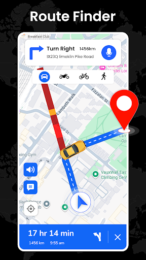
The core strength of this app lies in its real-time navigation capabilities combined with live traffic alerts. It tracks your current location accurately and offers the shortest possible routes to your destination. With constant updates on changing traffic conditions, it helps you avoid congestion and save valuable time. The integration of global traffic updates makes it particularly useful for daily commutes or long-distance travel across different regions.
Satellite Earth Maps and Explore Landmarks
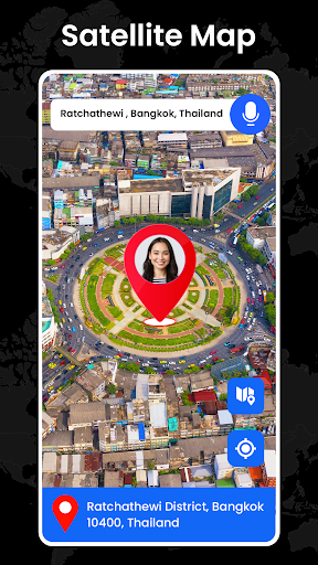
Experience the world from a satellite perspective with high-resolution Earth maps. The app supports various modes like night mode, terrain, and normal view, providing a realistic visual experience. You can easily locate famous landmarks, tourist attractions, and even pinpoint your house address on the satellite GPS map. Discover detailed imagery of well-known spots worldwide and explore GPS-tagged buildings or cities with a single tap, making planning your travels more interactive and engaging.
Intuitive Route Planner and Destination Search
The Route Planner feature simplifies trip planning by helping you plot routes efficiently. Search for any location using the straightforward interface, and the app will calculate the best route—whether by car, bicycle, or on foot. You can also save your favorite routes for quick access later. The app supports customized route options, such as avoiding tolls or selecting scenic paths, enhancing your travel flexibility.
Voice Navigation and Route Guidance
Navigate confidently with the built-in voice-guided directions. Specify your destination using voice commands and receive clear, step-by-step instructions throughout your journey. This feature is particularly handy when driving or cycling, allowing you to keep your focus on the road while still receiving accurate directions.
GPS Speedometer and Safety Features
The app includes a reliable GPS speedometer that displays your current speed in Km/h. It also offers over-speed alerts, helping you stay within safe limits. This feature is useful not only for drivers but also for cyclists, runners, or even sailors who want to monitor their speed and ensure safety during active travels.
Distance Calculation and Area Measurement
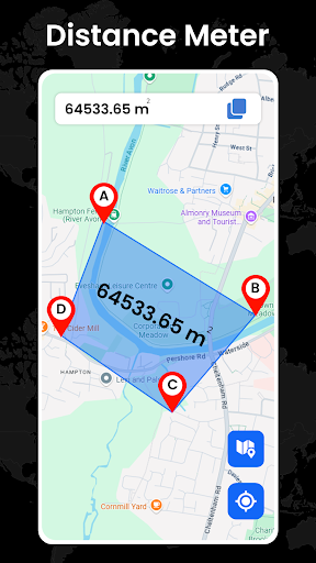
Plan your trips intelligently with the area calculator feature, which lets you measure distances between multiple points on the map. Whether you want to know how far your destination is or calculate the coverage of a particular area, this tool can provide measurements in both meters and kilometers effortlessly.
Additional Benefits and User Experience
Beyond its navigational prowess, GPS Earth Maps Live Navigation offers a suite of features that elevate your exploration. For example, it provides an accurate angle of inclination at your location, useful for outdoor activities or technical assessments. The satellite imagery extends to popular tourist destinations, allowing you to view landmarks and plan visits precisely. The app’s ability to locate well-known places with ease makes it a favorite for travelers and locals alike.
Moreover, the offline maps feature ensures you have access to essential information, even in areas with limited connectivity. This makes your adventures less dependent on internet availability—perfect for remote excursions or international trips. The app’s simple interface ensures that users of all tech levels can navigate confidently, making it suitable for everyone from casual explorers to experienced travelers.
Why Choose GPS Earth Maps Live Navigation?
If reliability, detailed mapping, and real-time updates are your priorities, this app is an excellent choice. It combines the convenience of satellite views, precise GPS location tracking, and robust route planning into one powerful package. Whether you're touring globally renowned landmarks or exploring your neighborhood, GPS Earth Maps Live Navigation enhances your travel experience with accuracy and ease.
In summary, this app is more than just a navigation tool—it's a comprehensive travel planner that aids exploration, safety, and efficient route selection. Embrace the future of navigation and make your journeys smooth, enjoyable, and well-informed with GPS Earth Maps Live Navigation.
Pros
- Accurate real-time GPS tracking
- Extensive worldwide map coverage
- Easy-to-use interface
- Supports offline map access
- Voice-guided navigation capabilities
Cons
- Frequent advertisements interrupt usage
- High battery drain
- Some features require in-app purchases
- Occasional app crashes reported
- Limited options for customization











