

Gaia GPS: Offline Trail Maps - The Ultimate Outdoor Navigation App
Are you an outdoor enthusiast seeking the perfect app to elevate your adventures? Look no further than Gaia GPS: Offline Trail Maps. This comprehensive navigation tool is designed to support hikers, bikers, campers, and explorers of all kinds. Whether you're planning a backpacking trip, mountain biking expedition, or solo hike, Gaia GPS offers a wealth of features to ensure you stay connected to nature while maintaining confidence in your navigation skills.
Explore the Outdoors with Confidence
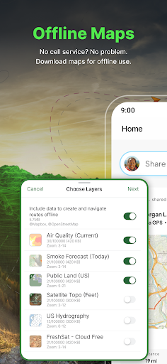
One of the standout features of Gaia GPS is its impressive offline capabilities. Imagine venturing deep into remote wilderness areas where cellular service is nonexistent—this app allows you to download detailed maps and trail routes beforehand. During a recent hiking trip, I appreciated not having to worry about losing signal, as I could still access topo maps, trail layers, and navigate confidently without internet connection. This functionality truly makes Gaia GPS an essential tool for backcountry adventures.
Feature-Rich for Every Outdoor Enthusiast
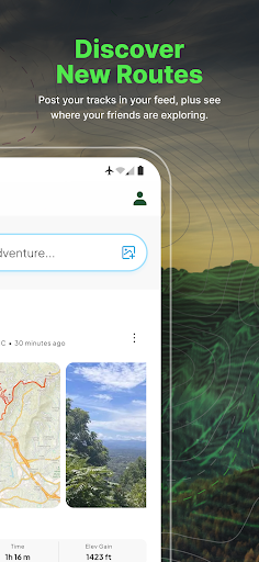
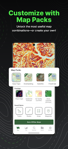
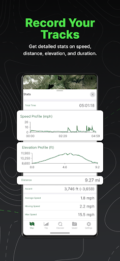
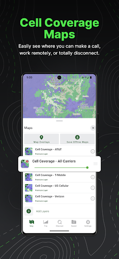
Gaia GPS is more than just a map app; it’s a complete outdoor activity toolkit. Users can access a variety of map layers such as topographic maps, satellite imagery, and weather updates, all integrated into one platform. The app's route tracking feature logs your trail performance — including distance, elevation, and speed. This is perfect for reviewing past trips and planning future adventures.
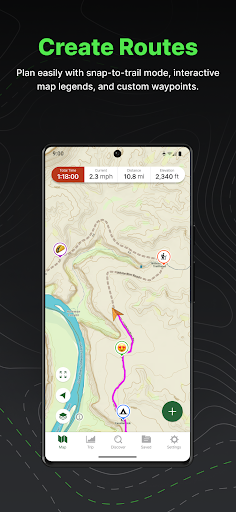
Custom route planning is another highlight—set waypoints, adjust your path, and share routes easily with friends. If you're in a group, Gaia GPS makes it simple to track friends’ locations in real-time, adding an extra layer of safety and social fun. Whether you’re exploring national parks, off-road trails, or scenic hiking routes, Gaia GPS adapts to your needs with features like breadcrumb trails, multiple map overlays, and comprehensive trail information.
Intuitive User Experience & Sleek Design
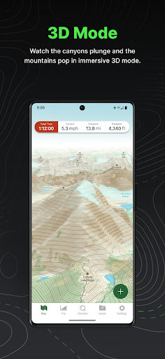
The app features a clean, user-friendly interface designed to accommodate both tech-savvy explorers and newcomers. Navigating through different features is straightforward—layers switch seamlessly, and options are easy to find. Although the multitude of features may present a slight learning curve initially, the overall experience remains fluid once you're familiar with the layout. The vibrant map visuals and clear icons enhance usability, making planning and exploration both efficient and enjoyable.
Perfect for Various Outdoor Activities
Besides hiking and backpacking, Gaia GPS is ideal for off-road adventures such as 4x4 trips, trail running, and backcountry camping. Users can locate and navigate to campgrounds across national parks, forests, or scenic landscapes using GPS coordinates. For those interested in winter sports, Gaia GPS provides access to ski slopes and cross-country skiing trails, along with current weather conditions from sources like OnTheSnow.
The app also supports road trip planning with offline maps that track your location even far from cell coverage, making it a reliable companion for RV travel. Offroad activity planning such as overlanding is simplified with route and waypoint management, all displayed comfortably on screens like Android Auto.
Elevate Your Adventure with Gaia GPS Premium & Outside+
Upgrade to Gaia GPS Premium with Outside+ for an even richer experience. Enjoy access to over 300 maps, including NatGeo Trails Illustrated and Private Lands. Features include offline maps, terrain data, weather forecasts, and safety tools. The subscription also grants access to the Trailforks GPS biking app, expert-led courses, and exclusive content like award-winning films and live TV from Outside Network.
Getting Started & Subscription Management
To begin your adventure with Gaia GPS, create an Outside account. Managing your subscription is simple—auto-renewal can be turned off at any time via the Google Play support page. All subscription details, including renewal policies and privacy terms, are accessible through the app’s links.
Conclusion
Whether you’re into backpacking, mountain biking, trail running, or exploring scenic off-road routes, Gaia GPS: Offline Trail Maps is your ultimate outdoor companion. Its powerful offline maps, detailed trail data, route planning features, and user-friendly design make it an indispensable app for nature lovers and adventure seekers alike. Prepare for your next expedition with Gaia GPS and discover new wilderness destinations, all while navigating confidently and safely.
Pros
- Wide range of offline maps available
- Intuitive interface and easy navigation
- Detailed trail information provided
- Regular updates introduce new features
- Option to customize map layers
Cons
- Subscription required for premium features
- GPS accuracy can sometimes be inaccurate
- Few social sharing options
- High battery usage during use
- Steep learning curve for new users











