
Explore the Vast Public Lands of the USA with the BLM Public Lands Map Guide App
The United States of America is renowned for its diverse landscapes, from lush forests and striking deserts to breathtaking vistas and historic sites. While many are familiar with its iconic landmarks, few realize the immense expanse of public Bureau of Land Management (BLM) properties spanning the Western US. The BLM Public Lands Map Guide USA app serves as your ultimate companion for discovering these hidden natural treasures and maximizing your outdoor adventures.
Designed to cater to everyone—from seasoned explorers to casual nature enthusiasts—this innovative app offers a comprehensive, up-to-date database of over 52,000 recreational points across BLM lands as of Summer 2024. Its intuitive interface and detailed mapping features make navigation straightforward, whether you're seeking a serene camping spot, a scenic vista, or new hiking trails.
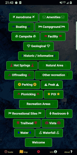
The app features a variety of color-coded icons that symbolize different point categories, including Access Points, Boating, Campgrounds, POIs, Vistas, Bathrooms, Parking Lots, Recreational Areas, and many more. It also provides clear delineation of property boundaries, and includes some trails and roads to help plan your routes. The latest updates have introduced a My Points tool, enabling users to create personalized points with custom colors and icons—and even export them for future reference.
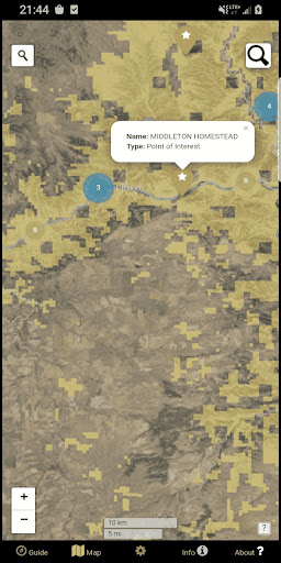
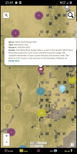
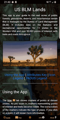
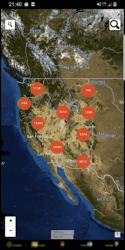
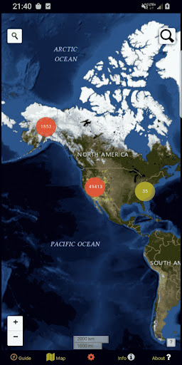
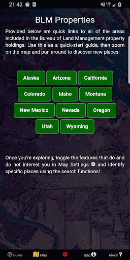
Navigation is supported through five main screens. The Guide screen offers data legends and useful tips for an optimized experience. The Info screen provides spatial links to various BLM properties, allowing quick access to detailed information about specific locations. The About screen details the open-source resources powering the app and offers insights into the developer, GeoPOI. The Map Settings screen lets users toggle between different basemaps, download offline imagery, enable geolocation, and customize point categories. The central Map screen integrates all features, with cluster indicators that reveal how many points are nearby at different zoom levels, and detailed icons for trails, boundaries, and places of interest.
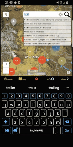
The map’s search tools are highly functional—one allows address and town lookups, while the other queries feature names within the database. This makes planning your outdoor excursions both easy and efficient. Whether you're seeking remote camping spots, hiking trails, or scenic photography locations, the BLM Public Lands Map Guide USA delivers a wealth of information at your fingertips, transforming the way you explore America’s public lands
Realize the endless beauty waiting to be uncovered in your own backyard or across the country. As the most accessible digital guide to public lands management in the USA, this app makes navigation seamless and enhances your outdoor experience. It invites you to connect with nature while paying homage to our rich natural and cultural heritage. Now, it’s easier than ever to embark on adventures on BLM lands from coast to coast, whether you’re hiking remote trails, discovering new campsites, or exploring scenic vistas.
Experience the great outdoors like never before with the BLM Public Lands Map Guide USA. Your gateway to exploring and enjoying the expansive public lands of the United States awaits—download today and start your adventure!
Designed to cater to everyone—from seasoned explorers to casual nature enthusiasts—this innovative app offers a comprehensive, up-to-date database of over 52,000 recreational points across BLM lands as of Summer 2024. Its intuitive interface and detailed mapping features make navigation straightforward, whether you're seeking a serene camping spot, a scenic vista, or new hiking trails.
The app features a variety of color-coded icons that symbolize different point categories, including Access Points, Boating, Campgrounds, POIs, Vistas, Bathrooms, Parking Lots, Recreational Areas, and many more. It also provides clear delineation of property boundaries, and includes some trails and roads to help plan your routes. The latest updates have introduced a My Points tool, enabling users to create personalized points with custom colors and icons—and even export them for future reference.
Navigation is supported through five main screens. The Guide screen offers data legends and useful tips for an optimized experience. The Info screen provides spatial links to various BLM properties, allowing quick access to detailed information about specific locations. The About screen details the open-source resources powering the app and offers insights into the developer, GeoPOI. The Map Settings screen lets users toggle between different basemaps, download offline imagery, enable geolocation, and customize point categories. The central Map screen integrates all features, with cluster indicators that reveal how many points are nearby at different zoom levels, and detailed icons for trails, boundaries, and places of interest.
The map’s search tools are highly functional—one allows address and town lookups, while the other queries feature names within the database. This makes planning your outdoor excursions both easy and efficient. Whether you're seeking remote camping spots, hiking trails, or scenic photography locations, the BLM Public Lands Map Guide USA delivers a wealth of information at your fingertips, transforming the way you explore America’s public lands
Realize the endless beauty waiting to be uncovered in your own backyard or across the country. As the most accessible digital guide to public lands management in the USA, this app makes navigation seamless and enhances your outdoor experience. It invites you to connect with nature while paying homage to our rich natural and cultural heritage. Now, it’s easier than ever to embark on adventures on BLM lands from coast to coast, whether you’re hiking remote trails, discovering new campsites, or exploring scenic vistas.
Experience the great outdoors like never before with the BLM Public Lands Map Guide USA. Your gateway to exploring and enjoying the expansive public lands of the United States awaits—download today and start your adventure!
Discover the Ultimate Guide to Exploring Public Lands in the USA
When it comes to exploring the vast expanse of public lands in the USA, the BLM Public Lands Map Guide USA is like having a treasure map in your pocket. I took this app for a spin, and let me tell you, it’s a game-changer for anyone who loves the great outdoors.
Discovering the Great Outdoors
As someone who’s always on the lookout for new trails and camping spots, I was thrilled to dive into the BLM Public Lands Map Guide USA. Right off the bat, the app impressed me with its extensive database of public lands. Whether you’re into hiking, camping, or just a casual day trip, this app has got you covered. It’s like having an encyclopedia of nature right at your fingertips.
User-Friendly Navigation
One of the standout features of this app is its user-friendly interface. I’m not exactly a tech wizard, but navigating through the app was a breeze. The layout is intuitive, with clear categories and an easy search function. Within minutes, I was able to find detailed maps and information about nearby public lands. It’s perfect for planning that spontaneous weekend getaway!
Detailed Maps and Information
Now, let’s talk about the maps. They’re detailed, to say the least. The app provides topographic maps, satellite views, and even terrain information. It’s like having a mini-GPS system combined with a guidebook. I could zoom in and out to see trails, campgrounds, and specific points of interest. The information is comprehensive, yet easy to digest. What really blew me away was the offline access feature—once maps are downloaded, you can access them even in remote areas with no cell service, making it ideal for wilderness adventures.
Community and Updates
The app also features a community aspect where users can share their experiences and tips. I found this helpful for discovering hidden gems and avoiding crowded spots. Plus, the app is regularly updated with new information, ensuring you always have the latest data at your fingertips.
To sum up, the BLM Public Lands Map Guide USA is an essential tool for any outdoor lover. Whether you’re an experienced hiker or just starting to explore, this app offers detailed maps, useful features, and community insights that enhance your adventures. It’s like having a trusted guide, a detailed navigation map, and a lively outdoor community all rolled into one. So why wait? Download the app today and start exploring the incredible public lands of the United States.
Discovering the Great Outdoors
As someone who’s always on the lookout for new trails and camping spots, I was thrilled to dive into the BLM Public Lands Map Guide USA. Right off the bat, the app impressed me with its extensive database of public lands. Whether you’re into hiking, camping, or just a casual day trip, this app has got you covered. It’s like having an encyclopedia of nature right at your fingertips.
User-Friendly Navigation
One of the standout features of this app is its user-friendly interface. I’m not exactly a tech wizard, but navigating through the app was a breeze. The layout is intuitive, with clear categories and an easy search function. Within minutes, I was able to find detailed maps and information about nearby public lands. It’s perfect for planning that spontaneous weekend getaway!
Detailed Maps and Information
Now, let’s talk about the maps. They’re detailed, to say the least. The app provides topographic maps, satellite views, and even terrain information. It’s like having a mini-GPS system combined with a guidebook. I could zoom in and out to see trails, campgrounds, and specific points of interest. The information is comprehensive, yet easy to digest. What really blew me away was the offline access feature—once maps are downloaded, you can access them even in remote areas with no cell service, making it ideal for wilderness adventures.
Community and Updates
The app also features a community aspect where users can share their experiences and tips. I found this helpful for discovering hidden gems and avoiding crowded spots. Plus, the app is regularly updated with new information, ensuring you always have the latest data at your fingertips.
To sum up, the BLM Public Lands Map Guide USA is an essential tool for any outdoor lover. Whether you’re an experienced hiker or just starting to explore, this app offers detailed maps, useful features, and community insights that enhance your adventures. It’s like having a trusted guide, a detailed navigation map, and a lively outdoor community all rolled into one. So why wait? Download the app today and start exploring the incredible public lands of the United States.
Pros
- Provides extensive coverage of public land maps.
- Offers an intuitive interface that simplifies navigation.
- Supports offline map access for remote locations.
- Keeps data current with regular updates.
- Provides detailed information on trails and campsites.
Cons
- Full access requires a subscription fee.
- GPS accuracy can sometimes be unreliable.
- Has limited features for interactivity.
- Consumes significant battery power on devices.
- Initial configuration may take considerable time.











