UAV Forecast for Drone Pilots
Are you a drone enthusiast or professional pilot looking for a reliable and comprehensive weather app to enhance your flying experience? UAV Forecast for Drone Pilots is a standout tool designed to provide detailed weather insights, navigation data, and flight restrictions all in one user-friendly platform. Whether you're flying a DJI Neo, Mini, Mavic, Air, Inspire, FPV drone, Autel, Skydio, or any other Unmanned Aerial Vehicle (UAV), this app is tailored to help you make informed decisions before taking off.
All-in-One Flight Planning Tool
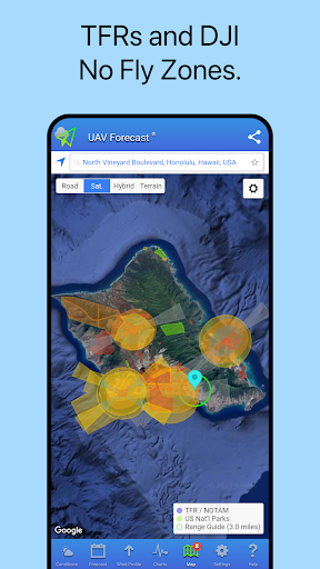
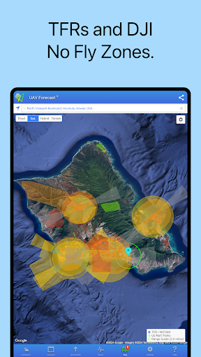
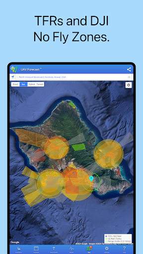
This innovative app consolidates critical flight information, including • weather forecast data, GPS satellite status, solar activity indices such as the • Kp index, and No-Fly Zones or flight restrictions, into a single convenient interface. With UAV Forecast, drone pilots can easily assess whether conditions are suitable for flight, reducing the risk of accidents or legal issues. The tool supports a broad range of drones and systems, making it versatile for hobbyist and commercial operators alike.
Feature Highlights
Designed for both beginners and advanced pilots, UAV Forecast offers a suite of features to optimize your flying sessions. Some key functionalities include:
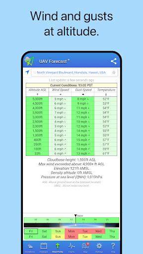
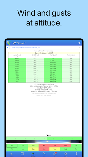
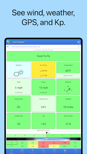
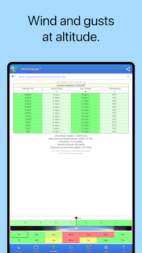
- Hyperlocal weather data, which provides detailed wind and gust speeds at ground level and at various altitudes, ensuring you know exactly when it's safe to fly.
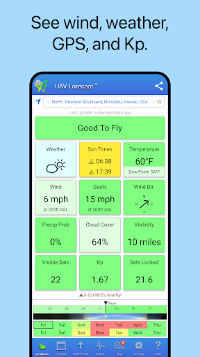
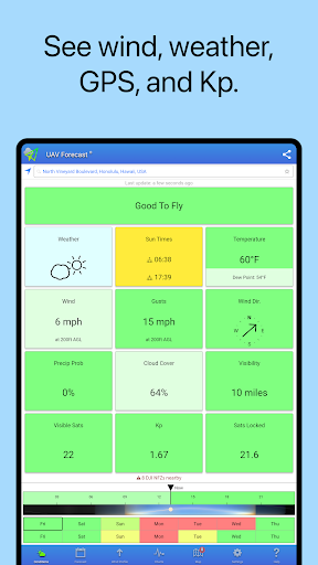
- GPS satellite data, including support for Galileo and GLONASS systems, along with solar weather metrics like the • Kp index, helping you gauge space weather conditions that may influence your drone's operation.
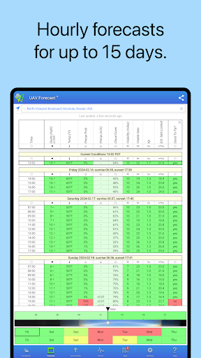
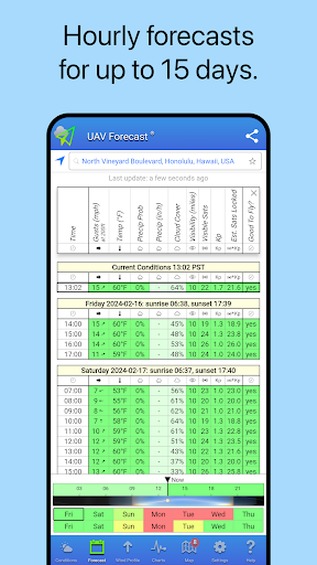
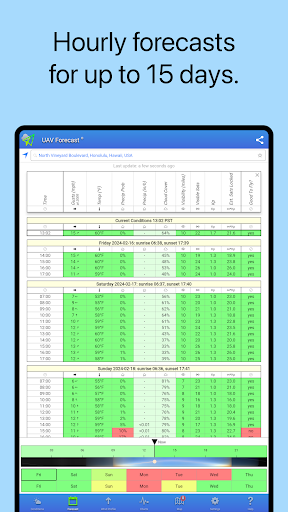
- Hourly forecasts up to 15 days into the future, enabling long-term planning for your drone missions.
- Automatic color-coded analysis that indicates flight suitability: green for Good To Fly and red for Not Good To Fly, simplifying risk assessment.
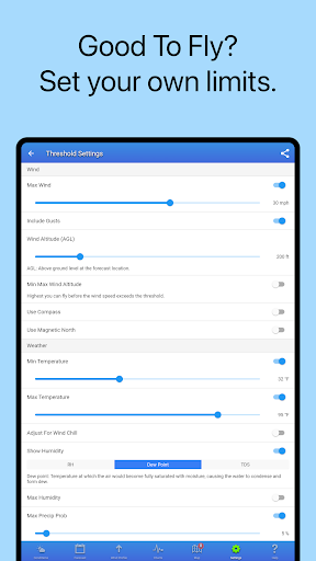
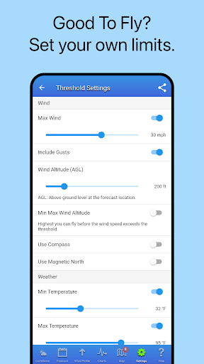
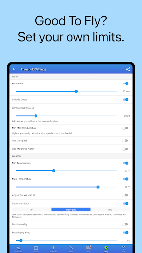
- Fully customizable threshold settings to match your specific drone's capabilities and personal safety standards.
- Light and Dark themes, with automatic switching based on sunrise and sunset times, to improve usability in different lighting conditions.
- Support for location search and managing Favorite Locations, making it easy to access weather info for multiple sites.
- Full tablet support for an optimal experience on larger screens.
Interestingly, the user base isn't limited to drone pilots; paraglider and paramotor enthusiasts also rely on this application for safe and enjoyable flights.
Why It's a Must-Have for Drone Pilots
Imagine having a crystal ball into the skies—predicting weather changes, assessing GPS satellite coverage, and understanding flight restrictions in real-time. UAV Forecast for Drone Pilots effectively becomes your trusted co-pilot, guiding you through safe flight planning. Its intuitive interface makes it accessible to all skill levels, and customizable features ensure you have relevant data at your fingertips.
One of the standout qualities of this app is its focus on safety. Accurate • weather forecasts help you avoid flying during gusty winds, thunderstorms, or other hazardous conditions. Meanwhile, GPS satellite data assures optimal connectivity, which is vital for drones relying on GPS for stability and navigation.
Additionally, the app offers helpful pre-flight checklists, ensuring that your drone's equipment — battery levels, propellers, and other essentials — are ready for takeoff. With regular updates improving functionality and adding new features, this tool continues to serve the evolving needs of drone pilots.
All these features collectively make UAV Forecast for Drone Pilots an indispensable app for anyone serious about safe, effective, and enjoyable drone flying. Its comprehensive approach to weather, navigation, and restrictions helps reduce risks and boosts confidence—empowering pilots to fly smarter, safer, and more responsibly.
Pros
- Provides accurate wind speed forecasts.
- Offers weather updates in real-time.
- Features an easy-to-use interface.
- Allows customization of alerts for different conditions.
- Displays detailed satellite map overlays.
Cons
- Free version has limited features.
- Requires internet connection for updates.
- Can consume battery quickly.
- May occasionally crash.
- Contains advertisements in the free version.