My Earthquake Alerts - Map: Comprehensive Earthquake Monitoring App
Discover the ultimate earthquake tracking experience with My Earthquake Alerts - Map, a powerful and user-friendly app designed to keep you informed about seismic activities worldwide. Whether you're living in an earthquake-prone region or simply interested in global seismic events, this free application offers real-time alerts, detailed earthquake data, and an intuitive interface—all optimized for the latest Android devices.
Key Features of My Earthquake Alerts - Map
This app provides a suite of features that make monitoring earthquakes easier and more informative:
• Live earthquake map:
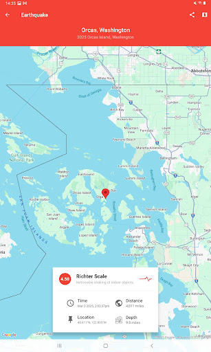
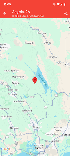
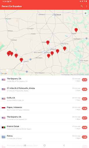
Enjoy an interactive map that detects and tracks earthquakes from all around the world. The map allows you to zoom in and out, pinpointing recent seismic events with precision.
• Custom earthquake alerts:
Set up personalized notifications for significant earthquakes based on your preferred criteria. The alerts are free, unlimited, and delivered via push notifications, ensuring you're promptly informed even when the app isn’t open.
• Extensive earthquake history:
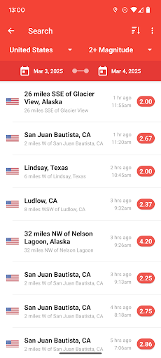
Dive into historical seismic data dating back to 1970. This powerful search feature helps you analyze patterns and gain insights into seismic activity over the years.
• Clear and simple design:
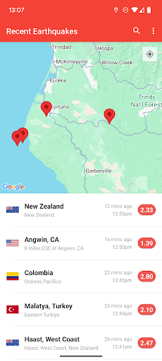
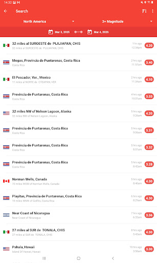
The app boasts a beautifully straightforward interface that displays earthquake feeds both visually on a map and in list form, making navigation effortless.
• Detailed event information:
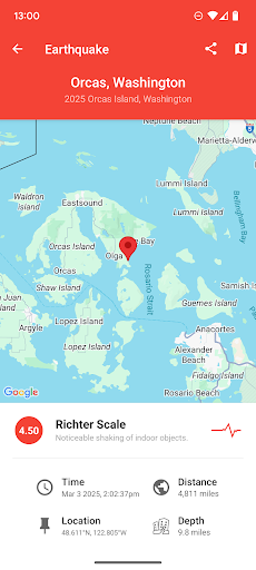
Get precise details such as magnitude, depth, and distance from your location. It sources data from reputable networks including USGS and EMSC for reliable updates.
Getting Started with My Earthquake Alerts - Map
Setting up My Earthquake Alerts - Map is simple. Upon installation, the app guides you through granting location access—crucial for local earthquake notifications. You can also customize alerts for specific regions or magnitudes, turning the app into a personal seismic watchdog. Its clean and responsive interface ensures a smooth onboarding process, even for first-time users.
Design and Performance Overview
The app's design emphasizes ease of use with a clean, intuitive layout. It features a dark mode option, perfect for late-night browsing while reducing eye strain. Performance-wise, My Earthquake Alerts - Map runs seamlessly, efficiently fetching and updating information without lag—even when handling large volumes of data from global networks.
Why Choose My Earthquake Alerts - Map?
Staying informed about seismic activities has never been easier or more accessible. This app not only offers comprehensive earthquake data but also ensures timely alerts, making it a vital tool for residents in earthquake zones or enthusiasts of earth science. Its powerful search capabilities and real-time maps empower users to monitor seismic trends and respond proactively. Plus, with regular updates and a straightforward design, My Earthquake Alerts - Map stands out as the best free earthquake monitoring application available today.
Pros
- Real-time earthquake alerts
- Intuitive and easy-to-use interface
- Customizable alert preferences
- Global coverage with detailed earthquake data
Cons
- Requires an internet connection
- Advertisements can be disruptive
- Limited free functionality
- Occasional delays in notifications
- No offline mode available