Overview of the Metar-Taf - Visual Decoder
Are you tired of sifting through dense and cryptic aviation weather reports? Do you wish there was a way to decode METAR and TAF data effortlessly and intuitively? Enter Metar-Taf - Visual Decoder, a comprehensive mobile application designed to visualize and simplify worldwide airport weather information. Whether you're a pilot, aviation professional, or weather enthusiast, this app transforms complex weather reports into a clear, colorful, and easy-to-understand format, enhancing your situational awareness and decision-making.
Main Features of the App
Visualized METAR and TAF Data
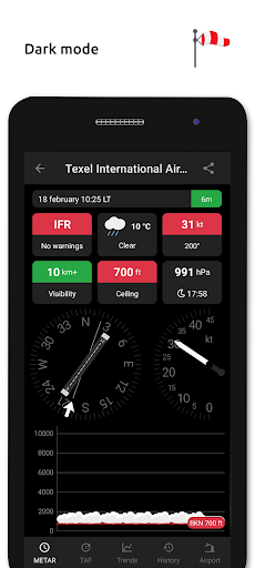
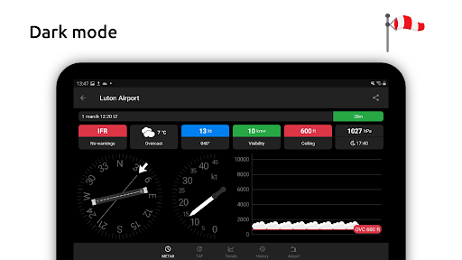
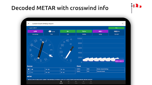
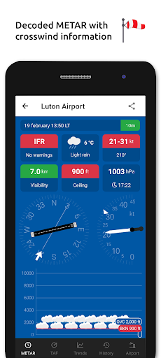
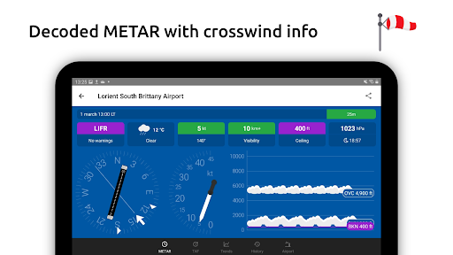
The app offers a visualized presentation of METAR and TAF reports for all airports globally. With colourful metrics and weather symbols indicating significant weather and cloud cover—similar to standard weather reports—users receive an at-a-glance understanding of current conditions. It also provides detailed crosswind calculations, combining METAR data with runway information, which is crucial for pilots preparing for takeoff or landing.
Flight Rules Classification
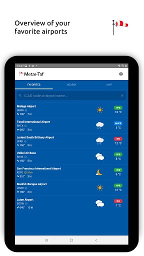
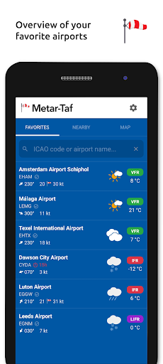
The app categorizes flight conditions into VFR, MVFR, IFR, and LIFR based on current visibility and weather patterns—key data points for pilots and air traffic controllers.
Text-to-Speech Functionality
Feeling multitask-minded? The read-out feature allows you to listen to decoded METAR reports through the built-in text-to-speech feature, helpful during busy pre-flight checks or when your hands are occupied.
Deep Dive into TAF Features
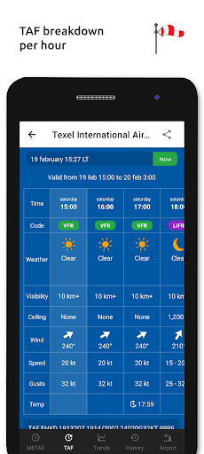
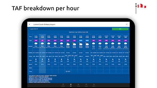
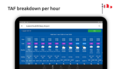
The TAF forecast is broken down hourly in a user-friendly table, providing clarity on expected weather changes. The app also displays sunrise and sunset times, as well as minimum and maximum temperatures, giving a comprehensive overview of upcoming conditions.
Monitoring and Tracking Weather Data
Favorite Stations & Nearby Observations
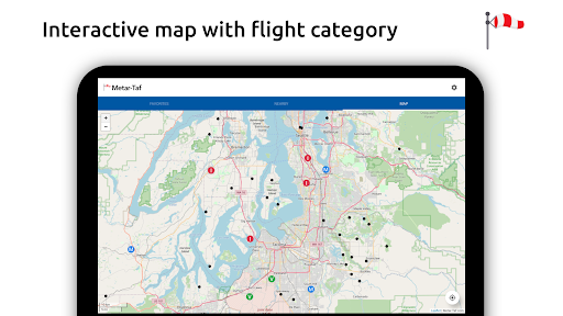
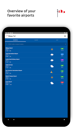
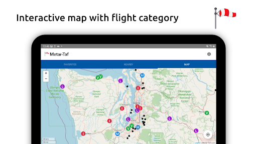
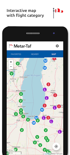
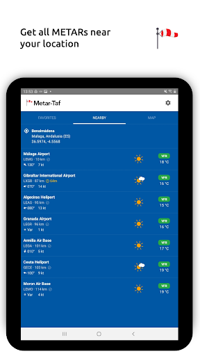
You can add favorite stations to your list for quick access. The app fetches observations near your current location, and you can explore stations on an interactive map by weather codes. Searching airports by ICAO code or name makes navigation seamless.
Historical Weather Data
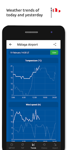
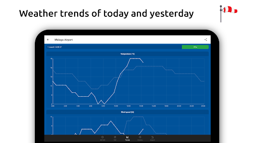
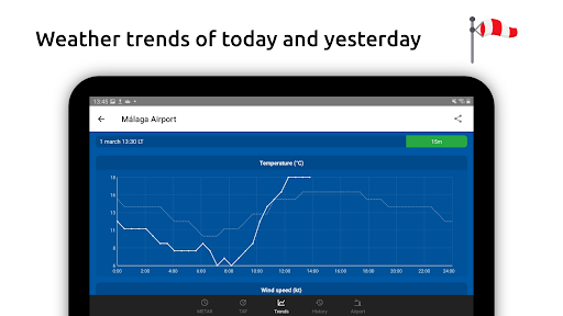
View graphs showing trends in temperature, visibility, wind speed, and QNH (altimeter setting) for today and yesterday. The app also preserves METAR history for the past hours, with links to detailed data on the website.
Airport Information & Data
Understand specific airport details such as runway directions, elevation, and location. If an airport doesn’t report a METAR, the app intelligently uses the nearest station’s data for calculations, ensuring accurate and comprehensive insights.
Advanced Calculations & Customization
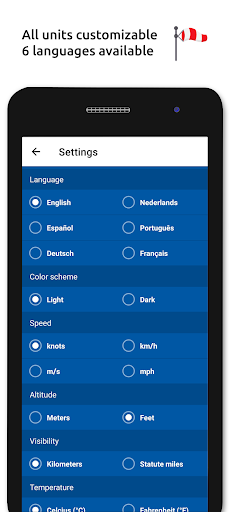
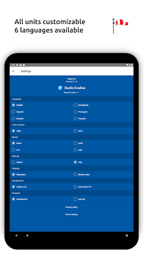
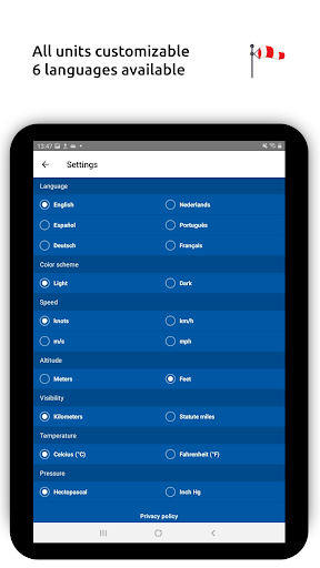
All units are customizable, supporting conversions for speed (knots, km/h, m/s, mph), altitude (meters/feet), visibility (kilometers/miles), temperature (Celsius/Fahrenheit), and air pressure (Hectopascal, Inch Hg). Times are automatically converted to the local time zone of each airport. Sunrise and sunset times are calculated based on the airport's latitude and longitude.
Offline Access & Multilingual Support
The app automatically saves METAR, TAF, and airport data for offline use. This feature is especially advantageous during flights when connectivity is limited. Additionally, the app supports 6 languages: English, Dutch, Spanish, Portuguese, German, and French, making it accessible to a global audience.
Why Choose Metar-Taf - Visual Decoder?
If you're involved in aviation or simply fascinated by weather patterns, this app is an indispensable tool. Its intuitive interface, real-time updates, and offline capabilities make deciphering METAR and TAF reports straightforward and efficient. No more tangled weather jargon—just clear, visual insights that help you plan, fly, or explore with confidence.
By transforming complex aviation weather data into an engaging, easy-to-understand format, Metar-Taf empowers users to make informed decisions quickly and accurately. Whether you're a pilot conducting pre-flight checks or a weather enthusiast tracking atmospheric trends, this app is designed to enhance your understanding of aviation weather like never before.
Pros
- User-friendly interface for easy navigation.
- Offers real-time weather updates.
- Supports multiple languages.
- Allows customization of weather alerts.
- Provides detailed weather data presentation.
Cons
- Needs a stable internet connection to function properly.
- Limited functionality when offline.
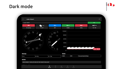
- Dark mode is not available.
- Can be overwhelming for new users.
- Premium features require a subscription.