Discover the US Public Lands App: Your Ultimate Guide to Nature’s Wonderland
Are you passionate about exploring the great outdoors and seeking a reliable tool to navigate the vast expanse of public lands across the United States? The US Public Lands app is designed to be your perfect companion, providing detailed maps and vital information about federal, state, and other public lands that are open for public use. Whether you're an avid hiker, camper, or simply love discovering scenic nature spots, this app transforms your outdoor adventures with its powerful features and user-friendly interface. Dive into this comprehensive guide to understand how the US Public Lands app can elevate your outdoor experiences and help you explore American wilderness responsibly and confidently.
Extensive Data on Federal and Public Lands
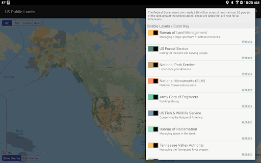
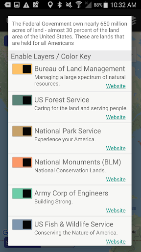
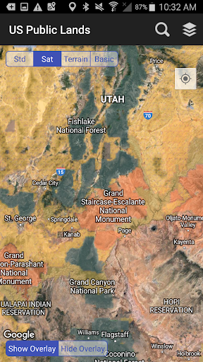
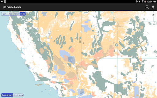
The US Public Lands app provides access to a vast database owned and maintained by the U.S. Federal Government, covering nearly 650 million acres—almost 30% of the land area of the United States. These lands are held for all Americans’ benefit, including national parks, forests, wildlife refuges, and other protected areas. Traditional navigation methods like physical maps or online searches can be cumbersome, especially when you're out in remote wilderness. This app resolves that issue by offering detailed, fully offline maps with selectable and beautifully color-coded layers for most of the key land management agencies such as:
- Bureau of Land Management (BLM)
- US Forest Service (FS)
- National Park Service (NPS)
- Army Corps of Engineers (ACOE)
- US Fish & Wildlife Service
- Bureau of Reclamation
- Tennessee Valley Authority
- Department of Defense (for military bases and installations)
- Other (including national laboratories and test sites)
Key Features and Benefits
The US Public Lands app is packed with features to enhance your outdoor adventures:
Customizable Map Layers
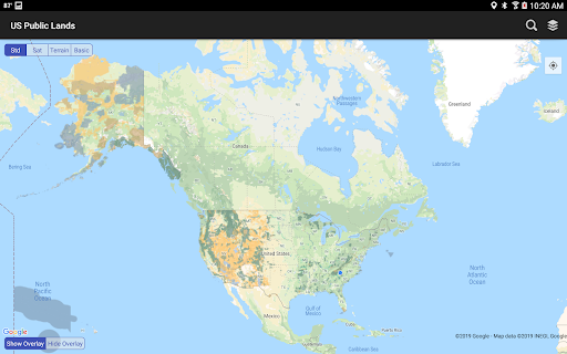
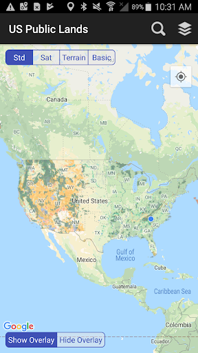
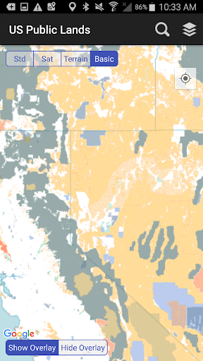
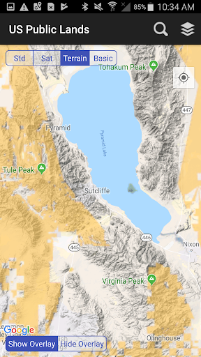
Easily toggle different layers to see which agency owns and operates the land you are exploring. The color-coding system makes it easy to differentiate the land boundaries and ownership at a glance. You can select specific agencies to display, helping you plan your activities according to land use rules and restrictions.
Integrated Agency Links
For in-depth research, the app provides direct links to each agency's website, offering detailed information about permits, fees, allowed activities, and stay limitations. This allows users to stay fully informed about land regulations before embarking on their adventures.
Offline Map Storage
All map layers—including the base map with public land labels—are stored directly on your device. This means you can access detailed maps without an internet connection, making this app invaluable for remote trips where connectivity is limited or nonexistent.
Flexible Map Viewing
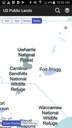
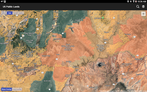
Switch effortlessly between static basic maps and dynamic views such as standard or satellite imagery. Turn the map on or off using simple icons, helping you better understand the terrain and spot dispersed camping spots, trails, and roads.
GPS and Search Capabilities
Use your device’s GPS to instantly locate your position within the public lands. Additionally, the built-in search tool allows you to find cities, ZIP codes, addresses, and points of interest, with a pin marking your location for easy navigation.
Adventure Planning Assistance
While the app doesn’t hold a specific database of individual campsites, using the satellite view can help you scout trails, find dispersed camping opportunities, and visualize land boundaries, acting as a boondocker's guide to outdoor exploration.
Reliable Data from a Trusted Source
The maps used in the US Public Lands app are generated from data provided by the Protected Area Database (PAD-US) of the U.S. Geological Survey. This openly available, public domain dataset offers the most comprehensive information on federal lands and waters. The app developers continuously update their maps in line with improvements to the dataset, ensuring users have current information. However, it is important to remember that, due to the evolving nature of this data, some boundaries may vary in resolution, and private inholdings within public lands may be unmapped. Users should always verify land boundaries and regulations with local authorities before engaging in activities like camping or hunting to ensure compliance and safety.
Designed for Outdoor Enthusiasts
Imagine yourself deep in the wilderness, seeking hidden trailheads, scenic vistas, or the perfect dispersed camping spot. The US Public Lands app acts as a knowledgeable guide in your pocket, making outdoor exploration more accessible and enjoyable. Its intuitive design ensures that even novice users can navigate the app effortlessly, while its comprehensive data appeals to seasoned adventurers. Whether you're planning a weekend getaway or an extended backcountry trip, this app helps you explore at your own pace, stay within legal boundaries, and discover the natural beauty that makes America’s public lands so extraordinary.
Final Thoughts
The US Public Lands app is more than just a mapping tool; it is your gateway to understanding and experiencing the majestic landscape of the United States. With offline capabilities, detailed land management information, and user-friendly features, it empowers outdoor lovers to explore responsibly and confidently. Download this app today to turn your outdoor dreams into reality and enjoy every moment spent in America’s magnificent public lands.
Pros
- Extensive map coverage.
- Available offline access.
- User-friendly interface.
- Detailed trail information.
- Regular updates.
Cons
- Limited free features.
- Requires GPS for accurate location.
- Lacks social sharing options.
- Depletes battery during extended use.
- In-app purchases are required.