
PeakVisor - 3D Maps & Peaks ID: Your Ultimate Mountain Navigation Companion
If you're passionate about exploring the mountains, whether through hiking, skiing, climbing, or mountain biking, PeakVisor offers a comprehensive suite of features designed to elevate your outdoor adventures. This innovative app combines state-of-the-art Peak Identification, 3D Maps, trail planning tools, and outdoor GPS tracking into a single, easy-to-use platform. It's more than just a navigation app; it's an immersive experience into the rugged terrain of our world's mountains, providing you with detailed insights that help you explore confidently and safely.
Powerful Features for Mountain Lovers
3D Maps
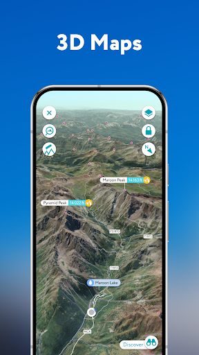
At the core of PeakVisor is its advanced 3D Mapping technology. These high-precision terrain models simulate mountain landscapes with stunning detail, offering a virtual glimpse of the terrain before you step outdoors. Whether you're planning an ascent or just want to get familiar with a mountain range, these maps allow you to rotate, zoom, and explore the landscape from every angle. This feature grants you deep insight into mountain terrains, making it easier to plan your routes, identify potential obstacles, and understand the nuances of the environment — all accessible at a glance.
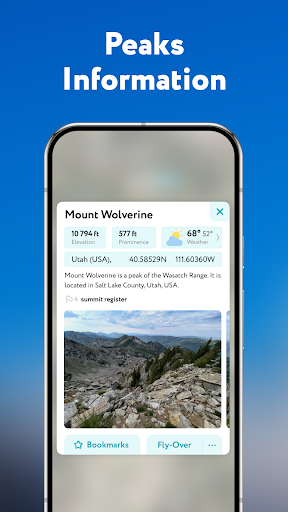
Identify Peaks
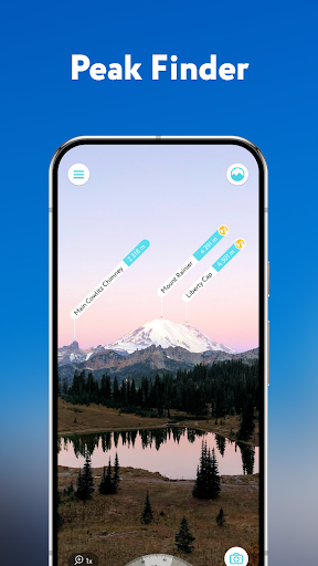
One of PeakVisor's most impressive capabilities is its extensive Peak Identification feature. With a database of over a million mountains, hills, spires, and formations worldwide, the app provides detailed profiles for each feature. When you point your device's camera at a mountain, the app instantly recognizes it and displays key information such as altitude, topographic prominence, mountain range, and nearby national parks or reserves. Supplemented with photos and Wikipedia articles, this feature makes discovering and learning about mountains effortless—even offline, making it indispensable in remote areas.
Route Planning and Navigation
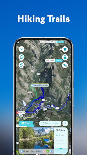
If you're planning a hike or outdoor expedition, PeakVisor's integrated tools are invaluable. The app includes a vast network of worldwide trails and pathways, allowing you to plan routes with detailed elevation profiles and estimated trekking times. You can save routes for offline access, ensuring navigation assistance without relying on network coverage. The app also overlays trail information directly onto the 3D maps, helping you assess route difficulty and make informed decisions in real-time.
Skiing and Winter Sports
During winter adventures, PeakVisor enhances your experience with features tailored to snow sports enthusiasts. The topographic 3D Maps provide visual terrain understanding, while detailed data about mountain lifts and ski resort trails help you navigate safely. Additional features like winter mode and slope steepness overlays assist in identifying avalanche-prone slopes, helping you plan safer routes in challenging winter conditions.
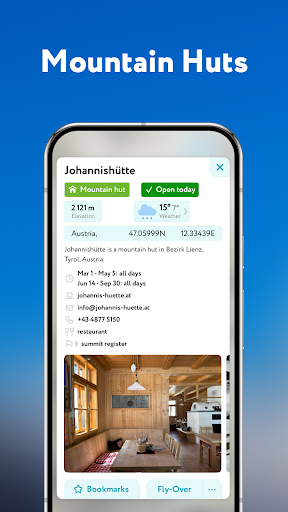
Cable Cars and Mountain Huts
In regions where accessibility via cable cars and mountain huts is common, PeakVisor offers integrated schedules and details about these facilities. This is especially useful in European mountain ranges, where combining cable car rides with hikes or stays at rustic mountain huts provides a truly authentic mountain experience. With this information at your fingertips, you can enjoy the local mountain culture and plan comfortable visits to high-altitude lodges and retreats.
Peak Bagging Challenges
For those motivated by climbing goals, PeakVisor includes monthly challenges and Peak Bagging competitions. These features encourage continued exploration and help you set personal records, making your mountaineering journey even more rewarding. Tracking your achieved peaks and competing with others adds a fun, competitive element to your outdoor pursuits.
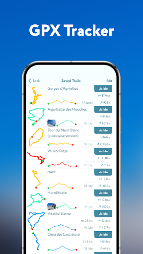
GPS Tracking and Route Visualization
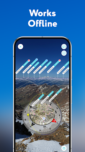
The app’s GPS tracking feature records your adventure, whether you're hiking, skiing, or mountain biking. After your trip, you can view your route in a miniature 3D environment, analyze stats like distance and elevation gain, and export your route data as a GPX file. This allows for detailed memory keeping, route sharing, and further trip planning. Plus, all features work offline, ensuring seamless use even in remote locations.
Why PeakVisor Is a Must-Have for Mountain Enthusiasts
In summary, PeakVisor is among the most versatile and powerful tools for outdoor explorers. It acts as a comprehensive mountain guide, map, and encyclopedia that fits conveniently on your device. Its focus on detailed terrain visualization, instant peak identification, and offline capabilities makes it indispensable for outdoor enthusiasts of all skill levels. Whether you're a seasoned climber or an occasional hiker, this app adds a new dimension to your adventures, offering safety, knowledge, and motivation in one package. Next time you're planning your mountain excursion, be sure to have PeakVisor installed to unlock the full potential of your outdoor adventures.
Pros
- Detailed 3D mountain maps
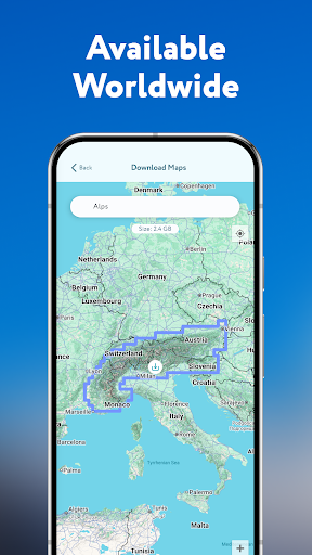
- Offline maps for remote areas
- Peak identification feature
- Augmented reality support
- Extensive global peak database
Cons
- Requires a subscription for full access
- Can drain battery quickly
- Occasional map rendering issues
- Limited free version features
- High data usage for downloads