
Discover PeakFinder: Your Ultimate Mountain Identification Companion
Have you ever been on a hike, immersed in the breathtaking scenery, and wondered about the names of the towering peaks in the distance? PeakFinder is the perfect solution for outdoor enthusiasts, nature lovers, and adventurers who want to identify mountains on the spot. This innovative app functions as your personal mountain guru, providing detailed names and panoramic views of more than 1,000,000 peaks worldwide.
Unveiling the Magic of PeakFinder
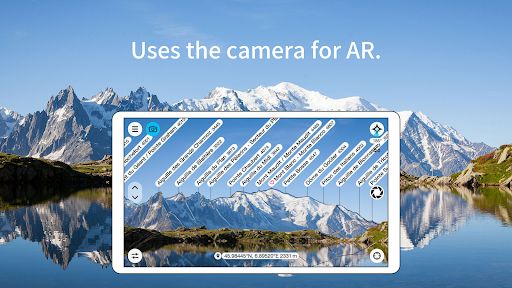
Whether you're exploring the Swiss Alps, the Rockies, or local hills, PeakFinder transforms your outdoor experience. Available on both Android and iOS, this app offers an easy-to-use interface that makes mountain identification effortless. Simply hold up your smartphone, point it towards the horizon, and instantly see the names of any visible peaks overlaid on your screen. It’s as if you have a high-tech digital telescope right in your pocket, turning every hike into an educational adventure.
How Does PeakFinder Work?
The app leverages your device's GPS and compass sensors to determine your precise location and orientation. It then cross-references this data with an extensive database encompassing over 850,000 peaks. Thanks to its offline functionality, you can explore mountain ranges in remote locations without an internet connection. This means whether you’re in the Swiss Alps, the Rocky Mountains, or just a local hill, PeakFinder ensures you always have mountain names at your fingertips.
Standout Features of PeakFinder
Offline & Worldwide Accessibility
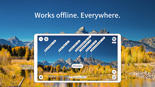
Explore mountains in any part of the world with full offline support, ensuring you never lose access to your mountain database during remote hikes.
Extensive Peak Database
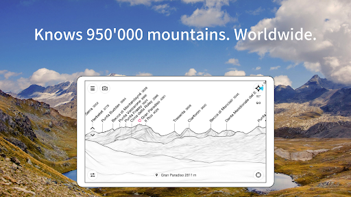
Identify over 1,000,000 peaks globally, from iconic giants to small local hills.
Augmented Reality & 360° Panorama
Experience a 360-degree panorama view of your surroundings, with real-time overlay of peak names. The augmented reality mode superimposes mountain labels onto your camera feed, giving you a stunning, interactive experience.
Peak and Landmark Marking
Create your own peak list by marking mountains and places you love or want to revisit.
Peak Exploration & Navigation
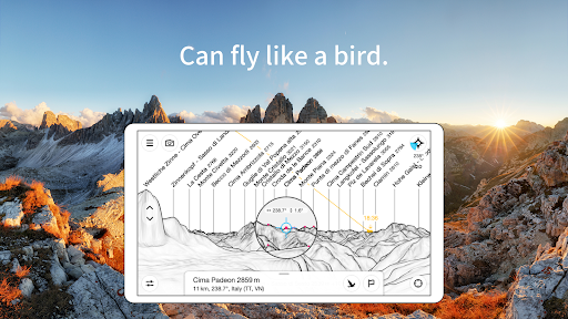
Utilize the 'show me' function to discover visible peaks and select your viewpoint via GPS, online maps, or the peak directory. You can even simulate flying like a bird from peak to peak, vertically upward or across landscapes.
Additional Useful Features
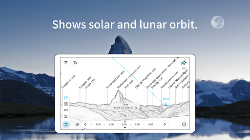
- Displays solar and lunar orbit with rise and set times
- Uses built-in compass and motion sensors for precise navigation
- Provides daily updates to the peak database
- Does not include any recurring costs—pay once and enjoy lifetime use
- Free of advertisements
Why You Should Incorporate PeakFinder into Your Outdoor Adventures
PeakFinder is more than just a mountain identification tool—it's an educational companion that enhances your appreciation for nature's grandeur. With its intuitive interface, you can quickly learn mountain names and details, making every hike an exciting quest for knowledge. Whether you're a seasoned mountaineer, a casual hiker, or a nature photographer, PeakFinder adds depth and fun to your outdoor explorations. Its comprehensive database, offline capabilities, and augmented reality features make it indispensable in remote or unfamiliar terrains.
Get Started with PeakFinder Today
If you're ready to elevate your hiking and outdoor experiences, PeakFinder is the perfect addition to your adventure toolkit. A small investment unlocks a world of knowledge and interaction with the majestic mountains around you. Download the app, lace up your hiking boots, and set out to explore the peaks with confidence and curiosity. Discover the history, names, and stories behind each mountain in your line of sight with PeakFinder.
Pros
- Stunning 3D panoramic views
- Offline functionality available
- Accurate peak identification
- User-friendly interface
- Regularly updated database
Cons
- Limited free features
- Requires GPS for optimal use
- High battery consumption
- No social sharing options
- Occasional app crashes