
Discovering OsmAnd — Maps & GPS Offline
Ever tried wandering through a new city and found yourself completely lost? Let me introduce you to OsmAnd — Maps & GPS Offline. This innovative app has been a lifesaver during my travels, offering reliable navigation even without an internet connection. Whether you're exploring unfamiliar streets, hiking remote trails, or cruising through coastal waters, OsmAnd provides detailed maps and navigation tools that make your journeys smoother and more enjoyable.
Unmatched Offline Navigation Power
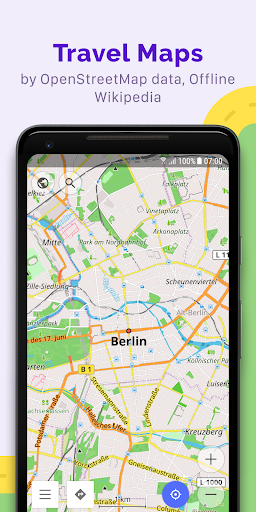
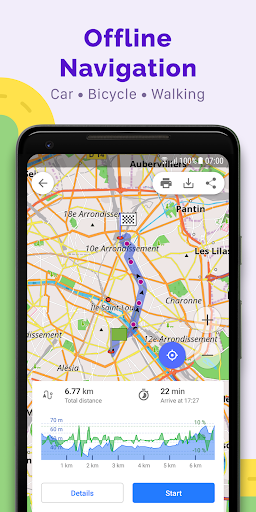
One of the most impressive features of OsmAnd is its ability to function entirely offline. You can download maps for almost anywhere in the world, which means you’re not dependent on mobile data or Wi-Fi during your adventures. This makes it perfect for international travel or remote areas where connectivity is limited. The app's open-source nature ensures transparency and privacy—OsmAnd does not collect user data, giving you full control over your information. It’s like carrying a personal GPS guide in your pocket, capable of guiding you through complex city streets, mountain terrains, nautical routes, or ski slopes.
User-Friendly Interface and Customization
Navigating OsmAnd is a breeze thanks to its clean and intuitive interface. The design is minimalistic, so you won't get overwhelmed by a cluttered layout or unnecessary icons. Everything is located where you would expect, making it easy for both beginners and experienced users to access its features seamlessly. Moreover, the app allows extensive customization. You can tailor the map display to highlight specific details such as bike paths, pedestrian routes, or off-road tracks, depending on your activity. Whether you prefer a touring style, nautical charts, winter maps, or topographic layouts, OsmAnd has a variety of map styles to suit your needs.
Advanced Route Planning and Recording
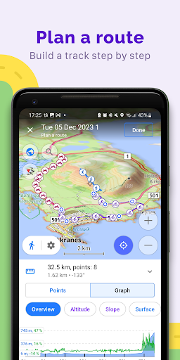
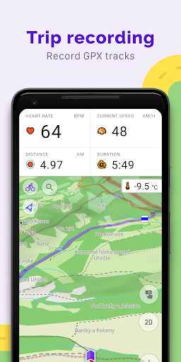
Planning your trip is simplified with OsmAnd's versatile route planning tools. You can plot routes point-by-point using multiple navigation profiles—be it for cars, bicycles, motorcycles, pedestrians, boats, or public transportation. The app permits you to customize routes by excluding certain roads or surfaces, ensuring your journey aligns with your preferences. During your trip, record GPX tracks to save your routes or share them with others. The app also offers visual data like elevation changes, distances, and descent/ascents, which is invaluable for outdoor enthusiasts and professional travelers alike.
Creating and Managing Points of Interest
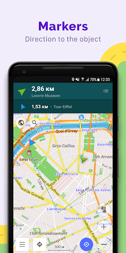
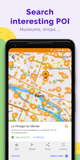
Stay organized during your travels by creating various points of interest. OsmAnd supports favorites, markers, and even audio/video notes, allowing you to mark important locations or jot down travel details. This makes exploring a new city more enjoyable and less stressful by keeping your data accessible and well-managed.
Contributing to OpenStreetMap
As an open-source application, OsmAnd allows users to contribute to the OpenStreetMap community. You can make edits directly to the map, update existing data, and help keep maps current with high frequency—up to every hour in some cases. Such community-driven updates ensure that navigation information remains accurate and up-to-date, benefitting travelers worldwide.
Additional Features Enhancing Your Navigation Experience
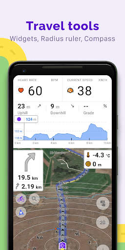
OsmAnd is loaded with supplementary features like a compass, radius ruler, access to Mapillary interface for street-level imagery, a night theme for low-light conditions, and integration with Wikipedia for enriching your journey with local knowledge. The app’s large user community, comprehensive documentation, and support resources further assist in making your travels hassle-free.
Premium Features with Maps+ and OsmAnd Pro
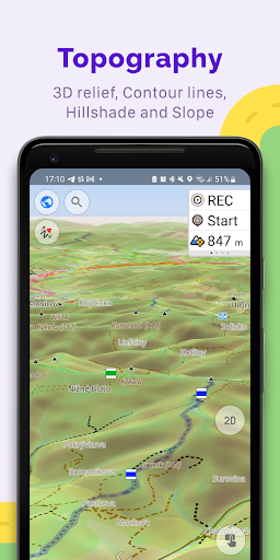
For enthusiasts craving more capabilities, OsmAnd offers paid add-ons. The Maps+ package unlocks Android Auto support, unlimited map downloads, topographic data including contour lines and terrain, nautical depths, offline Wikipedia articles, and Wikivoyage travel guides. Subscribing to OsmAnd Pro enhances your experience with cloud backup, faster map updates, weather plugins, elevation widgets, and support for external sensors like Bluetooth and ANT+. These features make OsmAnd not just a navigation app but a comprehensive travel tool.
Final Thoughts
If you're searching for a reliable offline navigation app that combines detailed maps, customizable features, and active community support, OsmAnd — Maps & GPS Offline is an excellent choice. Its robust functionality, privacy focus, and offline capabilities make it ideal for travelers, outdoor explorers, and anyone who needs accurate directions without internet dependency. Downloading and exploring new destinations has never been easier—and more secure—with this powerful navigation solution.
Pros
- Offline map access available
- Options to customize map views
- Frequent updates introducing new features
- Precise routing for multiple transportation modes
- Comprehensive maps for hiking and cycling
Cons
- User interface may be complicated for beginners
- Requires significant storage space due to large app size
- Certain features require additional purchases
- GPS signal can sometimes be unreliable
- Limited availability of real-time traffic information