
Discover the Ultimate Outdoor Navigation with onX Backcountry Trail Maps GPS
Are you passionate about exploring the great outdoors? Whether you're hiking, mountain biking, climbing, or backcountry skiing, having reliable navigation tools is essential for a safe and enjoyable adventure. The onX Backcountry Trail Maps GPS app is designed to be your perfect outdoor companion, offering a comprehensive suite of features that make exploring unfamiliar terrain easier, safer, and more fun. From detailed trail maps to real-time weather updates, this app consolidates everything you need into one powerful navigation system, elevating your outdoor experiences to new heights.
Accurate and Detailed Trail Maps for Every Adventure
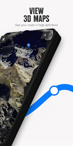
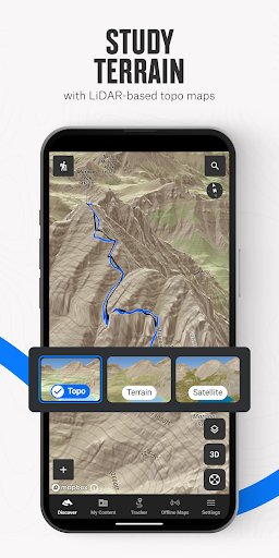
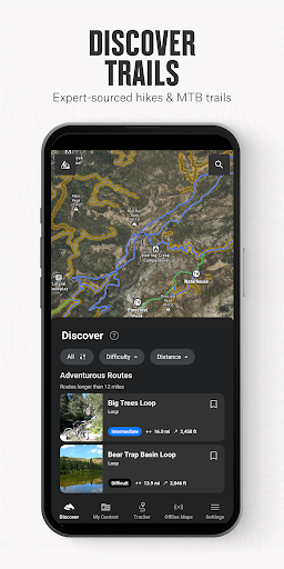
One of the standout features of onX Backcountry is its extensive library of trail maps covering over 650,000 miles of trails, 300,000+ rock climbs, and 4,000+ ski routes. Whether you're planning a scenic hike, a mountain biking trip, a rock climbing session, or a backcountry ski tour, this app provides tailored map layers such as topographic, satellite imagery, hybrid, and 3D views. This variety allows you to visualize terrain with impressive clarity, plan routes with precision, and assess elevation gains or slopes with just a few taps.
Plan, Navigate, and Stay Safe with Expert Tools
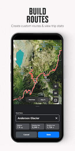
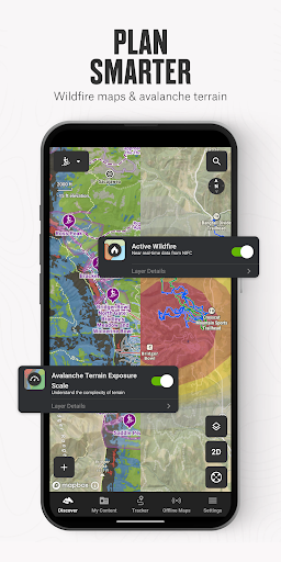
Preparation is key for a successful outdoor adventure. onX Backcountry empowers users to plan their trips seamlessly with features like the snap-to-trail route builder, setting Waypoints, and reviewing essential data like slope angle, slope aspect, and trail difficulty. Once on the trail, GPS tracking helps you keep tabs on your location with accuracy, enabling you to share your trip details or breadcrumb your route to keep track of your journey. The app also provides real-time updates on trail conditions, wildfire info, and hazard layers such as avalanches, ensuring you stay informed and safe throughout your trip.
Offline Maps and Route Measurement for Remote Exploration
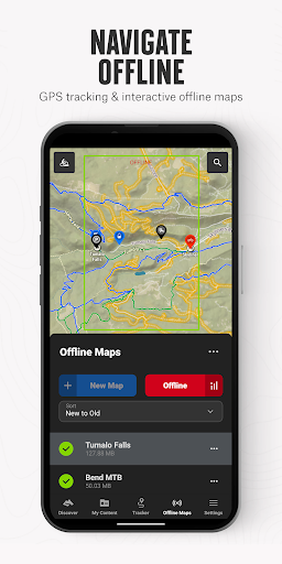
Venture into remote areas with confidence—onX Backcountry allows you to download maps for offline use, turning your smartphone into a dependable handheld GPS. This feature is invaluable when cell service is spotty or unavailable. You can also measure your distance, elevation gains, and trip stats, making it easy to track your progress and plan multiple-day excursions. The ability to navigate confidently even without connectivity ensures your adventures are not limited by terrain or coverage.
Weather and Trail Condition Intelligence
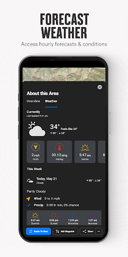
Stay ahead of nature’s unpredictable elements with localized weather updates, hourly wind forecasts, and 7-day weather predictions. The app offers trail reports submitted by fellow adventurers, providing real-world condition updates to help you decide whether to proceed or alter your plans. Additional layers like wildfire risk, smoke density, and air quality visualize environmental hazards affecting your route, allowing you to make informed decisions for your safety and comfort.
Comprehensive Data and Community Integration
onX Backcountry benefits from authoritative data sources including USFS, BLM, and NPS, providing verified trail info, land boundaries, and landowner details. The app’s community features allow users to share trail conditions, post reviews, and exchange tips. For premium users, even more detailed data like private land boundaries (Elite only) and recent satellite imagery are accessible, giving you an edge when navigating complex terrains.
Flexible Plans and Trial Opportunities
New users can take advantage of a free trial to explore the premium and elite features, unlocking access to millions of acres of public lands, hundreds of thousands of trailheads, privately owned land layers, and high-resolution topographic maps. Whether you’re a weekend warrior or a seasoned explorer, onX Backcountry’s comprehensive features are designed to enhance any outdoor activity while ensuring your safety and exploration efficiency.
Conclusion
The onX Backcountry Trail Maps GPS app is an essential tool for outdoor enthusiasts who want to explore with confidence. Its detailed maps, offline capabilities, real-time weather data, and safety features make it a versatile companion for all four-season adventures. Whether you’re venturing into remote mountains, navigating complex climbing routes, or skiing off-piste, this app equips you with the trustworthy data and tools needed to discover new terrains and stay safe. Download onX Backcountry today and take your outdoor pursuits to the next level.
Pros
- Offline access to comprehensive trail maps
- Provides real-time weather updates for safer hiking
- Features customizable route planning options
- Offers detailed topographic maps for various terrains
- Supports social sharing functionalities
Cons
- Requires a subscription to access premium features
- Consumes significant battery life during extended use
- Limited options for offline map downloads
- Reports of occasional GPS inaccuracies
- Interface may be complex and overwhelming for beginners