
Discover the All-New HuntStand App: Your Ultimate Hunting & Land Management Companion
HuntStand is a groundbreaking GPS maps and land management app designed specifically for hunters and outdoor enthusiasts. Recognized by Outdoor Life Magazine as the Best App for Hunters, HuntStand has cemented its position as North America’s #1 hunting & land management app with over 6 million downloads. The latest version offers a completely redesigned interface that elevates your scouting and navigation experience in the field. Whether you’re searching for property lines, exploring new hunting spots, or tracking deer movement, HuntStand is your go-to solution for a successful hunting season.
Key Features of HuntStand
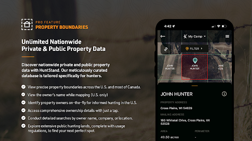
Nationwide Property Lines
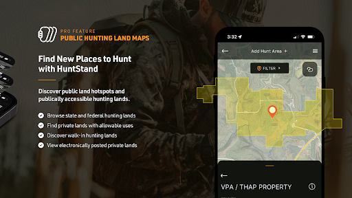
Gain access to private and public property boundaries and curated public land maps across all 50 states and most of Canada. This feature helps hunters avoid trespassing and find the best areas for hunting.
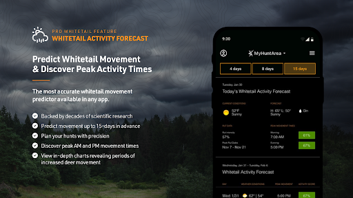
Advanced Whitetail Forecasts
Utilize the exclusive 15-Day Whitetail Activity Forecast tailored to your exact location. Knowing the ideal times for deer movement significantly increases your chances of a successful hunt.
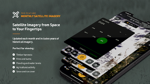
Monthly Satellite Imagery & Historical Archive
View monthly satellite imagery updates of your hunting areas, including historical visuals spanning multiple years. This helps in understanding land changes and planning your trips effectively.
Group Hunt Areas & Sharing
Seamlessly share hunt areas with friends, lease partners, and family members, making group planning easier and more organized.
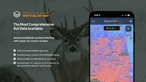
Nationwide Rut Map
The only county-level whitetail rut map visualizes peak rut dates through a color-coded system, helping hunters target the best times for deer activity.
Begin Mapping Today — Free Download
Download HuntStand at no cost and explore its powerful features designed to enhance your hunting and outdoor adventures. The app offers:
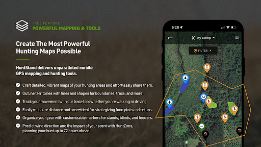
- GPS Mapping: View your real-time location, trace your movement, and add markers for key spots like tree stands.
- HuntZone Wind Forecast: Hour-by-hour scent impact predictions up to 72 hours in advance to ensure optimal hunt planning.
- Custom Map Creation: Design tailored maps of your hunting areas and share them easily.
- High-Resolution Satellite Imagery: Access detailed satellite images for precise navigation.
- Digital Rangefinder: Calculate distances in the field effortlessly.
Upgrade to HuntStand Pro for Enhanced Features
For only $29.99 per year, enjoy comprehensive hunting maps and advanced tools. Pro features include:
- Detailed property line maps and ownership data
- Monthly satellite imagery with historical archives
- Access to public hunting land maps and high-resolution aerial imagery
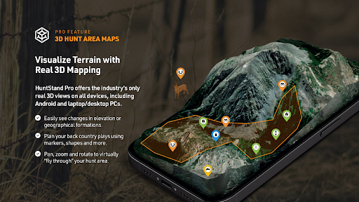
- 3D mapping for terrain navigation and planning
- Unlimited offline maps for remote areas without signal
Take Your Deer Hunting to the Next Level with HuntStand Pro Whitetail
Become a white-tailed deer specialist with HuntStand Pro Whitetail. This upgrade includes all the Pro features plus specialized tools such as:
- 15-Day Whitetail Activity Forecast for peak hunting times
- Annual Rut Map providing county-level rut dates and phases
- Habitat Mapping to identify prime deer habitats and find new hunting locations
This targeted approach enhances your chances of success during the critical rut periods and helps you locate prime habitat for white-tailed deer.
Additional Information
HuntStand’s privacy policy and terms & conditions ensure safe and secure use of the app. Charges apply to your app store account upon purchase, with options for ongoing subscription upgrades to maximize your outdoor adventures.
Conclusion
If you’re passionate about hunting or exploring the outdoors, HuntStand: GPS Maps & Tools is a must-have app that combines advanced mapping, real-time weather, and rich land data into an intuitive platform. It’s like having a trusted guide in your pocket, helping you plan, navigate, and succeed in your outdoor pursuits. Download HuntStand today and experience the power of professional-grade hunting tools designed explicitly for hunters of all levels.
Pros
- Provides detailed map layers suitable for hunting activities.
- Features an intuitive interface that simplifies navigation.
- Offers offline map access for use in remote locations.
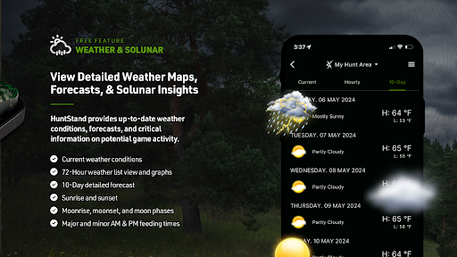
- Includes weather tracking functionalities tailored for hunters.
- Enables data synchronization across multiple devices.
Cons
- Certain features require a paid premium subscription.
- Uses significant battery power due to GPS functionality.
- Limited social features available for community interaction.
- May experience occasional delays when loading maps.
- Map coverage is not comprehensive for all regions.